


Hydrology is the scientific study of water, including its occurrence, distribution, movement, and properties across Earth’s atmosphere, land, and underground spaces. It explains how water supports life and human activities.
The hydrological cycle links evaporation, condensation, precipitation, infiltration, runoff, and groundwater flow. These processes move water continuously between oceans, rivers, soils, living organisms, the atmosphere, and the wider environment.
Because water availability changes with weather, geology, vegetation, and human activities, hydrology draws on several related disciplines. Its findings help communities plan reliable supplies and respond to environmental risks over time.
Hydrologists combine field observations, laboratory analysis, mathematical models, and digital tools to understand both water quantity and quality. This work informs farming, engineering, ecosystem protection, flood preparation, and pollution control.
The major branches of hydrology provide specialized ways to investigate different parts of the water system. Understanding these branches clarifies how scientists evaluate rivers, rainfall, aquifers, water chemistry, and ecological relationships.
Hydrology and the Water Cycle
Hydrology examines water as a connected resource rather than as isolated rivers, lakes, rainfall, or aquifers. The water cycle links these stores and transfers water through natural and human-influenced pathways.
Precipitation may soak into soil, flow across the surface, evaporate back into the atmosphere, or recharge underground aquifers. The proportions depend on vegetation, soil structure, slope, climate, and land use.
For example, soil and mineral resources influence infiltration and groundwater chemistry, while land clearing changes runoff patterns. Hydrologists therefore examine geology, soils, and vegetation across an entire drainage basin within catchments.
Climate variability can alter rainfall intensity, drought duration, and flood frequency. Understanding these shifts helps planners evaluate climate impacts on agricultural land and prepare for changing water availability across seasons.
Human activity also changes water movement through dams, paved surfaces, irrigation, deforestation, and water extraction. Studying the connection between people and environmental resources helps identify where management can reduce pressure.
Hydrology matters because every community needs dependable water for drinking, sanitation, food production, industry, and ecosystem health. Reliable measurements guide decisions about storage, drainage, pollution prevention, and conservation priorities during dry and wet periods.
Water balances compare the amount entering a catchment through precipitation and inflow with water leaving through streamflow, evaporation, and extraction. Such accounting reveals shortages, storage changes, and opportunities for better allocation.
At watershed scale, upstream activities can affect downstream water quantity and quality. Hydrologists therefore consider the whole basin, including urban drainage, farms, forests, wetlands, and communities that share connected water resources.
Read Also: Methods of Disposal of Waste Pesticide Containers
Major Branches of Hydrology
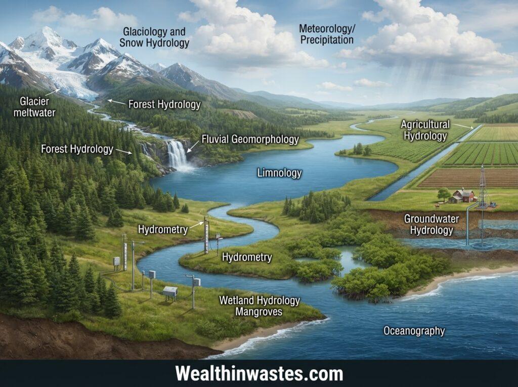
1. Chemical Hydrology: Chemical hydrology investigates dissolved minerals, nutrients, salts, gases, and contaminants in water. Researchers measure these characteristics to assess suitability for drinking, irrigation, industry, aquatic life, and to trace water pollution sources.
2. Ecohydrology: Ecohydrology explores two-way relationships between water and living organisms. Researchers study how vegetation influences infiltration, how wetland plants filter water, and how water availability shapes habitats, biodiversity, and water quality across ecosystems.
3. Surface Hydrology: Surface hydrology focuses on water above ground, including rivers, streams, lakes, reservoirs, and runoff. It helps estimate streamflow, map watersheds, assess flood hazards, and examine soil water-holding properties under different conditions.
4. Hydrogeology: Hydrogeology investigates groundwater occurrence, movement, storage, and interaction with rocks and soils. Specialists examine aquifers, recharge rates, and wells, including how heavy-metal contamination pathways can threaten underground water supplies over time.
5. Hydrometeorology: Hydrometeorology examines exchanges of water and energy among land, water surfaces, and the lower atmosphere. It connects rainfall, humidity, evaporation, and weather patterns to drought forecasting and flood-warning systems across regions.
6. Engineering Hydrology: Engineering hydrology applies water data to dams, culverts, bridges, drainage channels, reservoirs, and irrigation systems. Engineers estimate flow rates and flood peaks to design infrastructure that manages water safely under expected conditions.
7. Hydroinformatics: Hydroinformatics applies computing, geographic information systems, sensors, databases, and mathematical models to water resources. These tools help researchers organize observations, simulate scenarios, visualize risks, and support better operational decisions for water managers.
8. Isotope Hydrology: Isotope hydrology uses natural or introduced isotope signatures to trace water sources, estimate groundwater ages, and distinguish recharge pathways. The technique supports investigations of mixing, evaporation, and movement through aquifers and catchments.
Hydrology’s Role in Water Management

1. Water Supply Planning: Hydrologists estimate how much water rivers, reservoirs, and aquifers can provide across seasons. These estimates guide conservation, storage, and water waste management plans for growing communities.
2. Wastewater Management: Understanding wastewater sources and characteristics helps authorities select appropriate treatment and discharge methods. This knowledge helps prevent contaminants from reaching drinking supplies, agricultural water sources, and sensitive aquatic habitats.
3. Flood and Drainage Control: Rainfall records, stream gauges, land elevation, and soil data help experts estimate flood peaks. These findings support warning systems, drainage designs, emergency preparation, and safer settlement planning.
4. Pollution Prevention: Water-flow studies show where discharged materials may travel, settle, or accumulate. Combining hydrology with suitable wastewater treatment and discharge practices helps reduce risks to people, crops, fisheries, and ecosystems.
5. Water Allocation: Hydrological records help authorities balance competing needs from homes, farms, industries, and ecosystems. Seasonal estimates can guide fair allocation rules and help reduce overuse when supplies become limited.
6. Drought Preparedness: Long-term rainfall and groundwater records help experts identify dry periods and changing recharge patterns. Early planning can protect drinking-water supplies, guide irrigation schedules, and reduce losses during prolonged drought.
Methods Used in Hydrological Studies
1. Field Measurements: Hydrologists record rainfall, streamflow, river levels, soil moisture, and groundwater depth. Regular observations reveal seasonal patterns and provide reliable data for evaluating water availability, floods, and droughts.
2. Laboratory Analysis: Specialists test water samples for pH, conductivity, dissolved substances, nutrients, and microbes. Understanding the classes and sources of water pollutants helps them interpret results and identify possible contamination pathways.
3. Hydrological Modelling: Mathematical models estimate runoff, infiltration, groundwater movement, and changes under alternative weather or land-use conditions. Reliable models help researchers compare management choices before costly projects or interventions begin.
4. Remote Sensing: Satellite imagery and aerial measurements help map land cover, snow, wetness, and changing water surfaces over wide areas. These observations complement field gauges where access is limited or uneven.
5. Data Validation: Scientists compare measurements from different instruments and locations to find gaps or unusual values. Quality checks improve confidence in forecasts and reduce the chance that faulty observations misguide important decisions.
Practical Applications of Hydrology
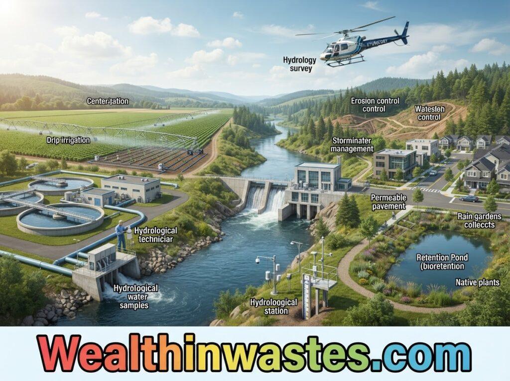
Hydrology supports agriculture by explaining rainfall patterns, soil moisture, irrigation demand, and drainage needs. Farmers and planners can use this knowledge alongside soil conservation and management practices to protect productive land.
Water-resource agencies use hydrological evidence to identify where supplies may become scarce and which areas face higher flood exposure. Monitoring also helps compare options for reservoirs, irrigation networks, and community water systems.
Pollution assessments combine water movement with knowledge of contaminant sources. Learning about water pollution sources and classifications helps decision-makers distinguish local discharges from diffuse runoff and target prevention measures effectively.
Hydrological data also informs economic planning because floods, droughts, and contamination can damage homes, farms, transport, and public infrastructure. Evaluating economic losses linked to pollution can strengthen investment in prevention and recovery.
In ecosystems, streams, wetlands, and groundwater sustain plants and animals through seasonal change. Hydrological assessments help protect environmental flows, preserve habitats, and balance human withdrawals with the needs of aquatic communities.
Water-resource planning increasingly considers future population growth, land development, and climate uncertainty. Hydrological scenarios help compare alternative choices and reveal where flexible infrastructure or conservation measures may deliver greater long-term benefits.
Farmers can use hydrological information to schedule irrigation more efficiently and reduce avoidable water losses. Linking rainfall forecasts with soil moisture observations also helps protect crops from water stress and excessive saturation.
Skills and Challenges in Hydrology
Hydrologists need careful observation, sound mathematics, environmental knowledge, and clear communication. They must also understand uncertainty because rainfall, land use, water extraction, and equipment limitations can affect measurements and forecasts.
Field conditions can create major challenges, including remote locations, broken gauges, limited funding, and incomplete historical records. Teams improve reliability by maintaining instruments, documenting methods, checking outliers, and comparing independent datasets.
Water contamination adds complexity because substances move differently through soil, rivers, and aquifers. Studies of environmental effects of waste disposal show why source control and long-term monitoring matter for public and ecosystem health.
Poorly managed waste may enter drainage channels during rainfall, carrying pollutants into surface water or groundwater. Understanding waste generation patterns and waste impacts on the environment helps hydrologists assess connected contamination risks across catchments.
Hazardous chemicals may persist in soil and move toward nearby water sources, depending on local conditions. Research on hazardous substances affecting soil and plants reinforces the need for careful handling, prevention, and regular environmental monitoring.
Strong hydrological decisions require transparent data sharing among scientists, water utilities, farmers, engineers, and public agencies. Coordination can improve early warnings, protect shared watersheds, and help communities respond consistently when water conditions change.
Read Also: Effective Ways to Protect Water Pollution
Summary on 8 Key Major Branches of Hydrology
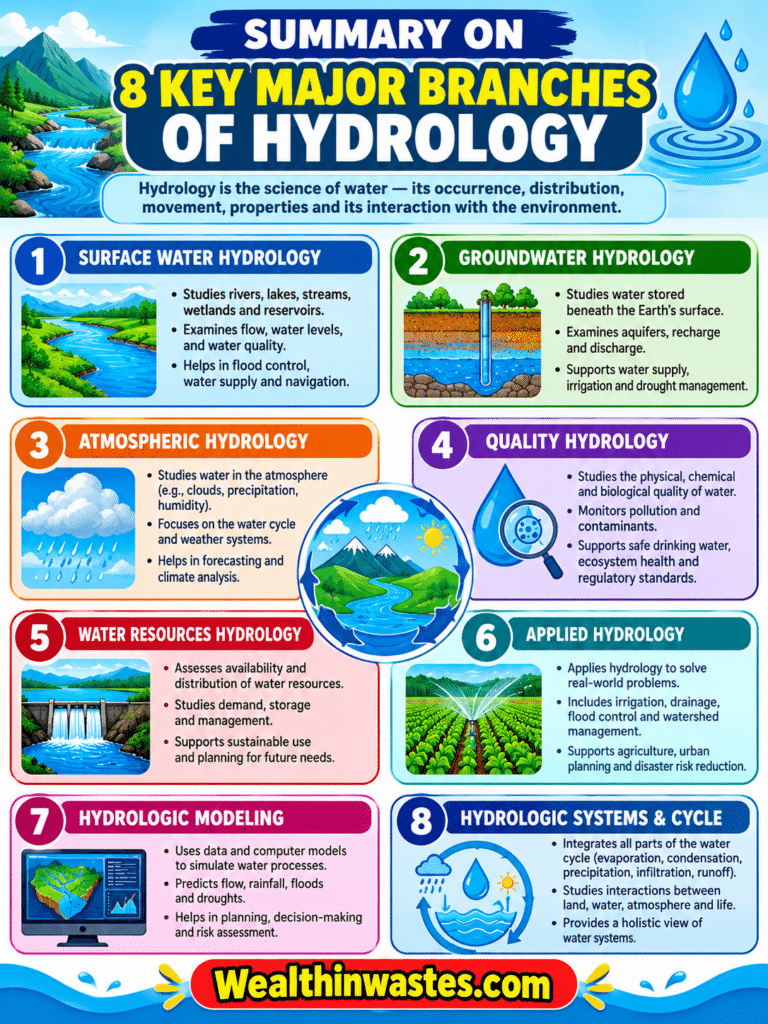
| Branch | Main Focus | Practical Application |
|---|---|---|
| Chemical Hydrology | Water chemistry and dissolved substances | Water-quality testing and contamination assessment |
| Ecohydrology | Relationships between water and organisms | Wetland and ecosystem protection |
| Surface Hydrology | Rivers, lakes, runoff, and surface flow | Flood assessment and watershed management |
| Hydrogeology | Groundwater occurrence and movement | Aquifer investigation and groundwater protection |
| Hydrometeorology | Water and energy exchanges with the atmosphere | Rainfall analysis and drought forecasting |
| Engineering Hydrology | Water flow and infrastructure design | Dams, drainage, bridges, and irrigation systems |
| Hydroinformatics | Information technology applied to water | Digital modelling and water-resource planning |
| Isotope Hydrology | Isotopic signatures and water pathways | Tracing water sources and groundwater recharge |
Frequently Asked Questions About Major Branches of Hydrology: 8 Key Fields Explained
1. What are the major branches of hydrology?
The major branches include chemical hydrology, ecohydrology, surface hydrology, hydrogeology, hydrometeorology, engineering hydrology, hydroinformatics, and isotope hydrology. Each branch examines a different aspect of water.
2. Which branch studies groundwater?
Hydrogeology studies groundwater, including where it occurs, how it moves through geological materials, how aquifers recharge, and how groundwater interacts with surface water and surrounding ecosystems.
3. How does hydrology help agriculture?
Hydrology helps farmers estimate water availability, plan irrigation and drainage, manage soil moisture, anticipate drought or flooding, and protect water sources used for crops and livestock.
4. What is the difference between surface hydrology and hydrogeology?
Surface hydrology examines rivers, lakes, runoff, and other water at or near the land surface. Hydrogeology focuses on groundwater stored and moving beneath the surface.
5. Why is chemical hydrology important?
Chemical hydrology measures water chemistry, including dissolved substances and contaminants. These findings help determine whether water is suitable for drinking, irrigation, industry, and aquatic organisms.
6. Which tools do hydrologists use?
Hydrologists use rain gauges, stream gauges, water samplers, laboratory instruments, remote sensing, geographic information systems, and computer models to measure processes and investigate possible future conditions.
Do you have any questions, suggestions, or contributions? If so, please feel free to use the comment box below to share your thoughts. We also encourage you to kindly share this information with others who might benefit from it. Since we can’t reach everyone at once, we truly appreciate your help in spreading the word. Thank you very much for your support and for sharing!
Read Also: Soil and Water Conservation in Agriculture