


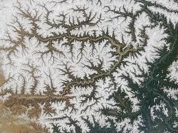
A drainage basin is a natural land area that collects rainfall and directs water toward a shared outlet, such as a stream, river, lake, or wetland, through connected surface and underground pathways.
It operates as a distinct hydrological system because water enters through precipitation, moves across or beneath the land, and leaves through river discharge, evaporation, and sometimes groundwater transfer to another basin.
Studying a drainage basin helps explain how rainfall becomes runoff, how soils store moisture, and why streams respond differently to storms across landscapes with contrasting geology, vegetation, relief, and land use.
Hydrologists use the basin as a practical unit for examining water balances, estimating flood risks, tracking sediment, and understanding how farming, settlements, roads, and pollution affect streams and downstream communities.
Because water carries dissolved substances and eroded particles, conditions in one part of a basin can affect habitats, agriculture, drinking-water sources, flood behaviour, and local livelihoods directly.
Drainage Basin Meaning and Definition
A drainage basin, also called a catchment or river basin, is the area of land from which surface runoff, subsurface throughflow, and connected groundwater contribute water to a common stream or outlet.
The basin functions within the hydrologic cycle, connecting rainfall, infiltration, storage, runoff, and evaporation; these processes determine when water reaches channels and how much discharge leaves the catchment after a storm.
A drainage divide separates neighbouring basins by following high ground, ridges, or other topographic boundaries; each side routes water toward a different outlet, although groundwater pathways may cross the surface divide.
Some sources use watershed as a synonym for drainage basin, while others use it for the divide itself; readers should check the context because terminology varies by country, discipline, and purpose.
Researchers examine the basin as part of the wider land and water environment, where soils, streams, groundwater, and living communities exchange water, nutrients, sediment, and energy across connected landscapes.
Read Also: Proper Methods of Disposal of Dilute Pesticide Waste
Key Features of a Drainage Basin
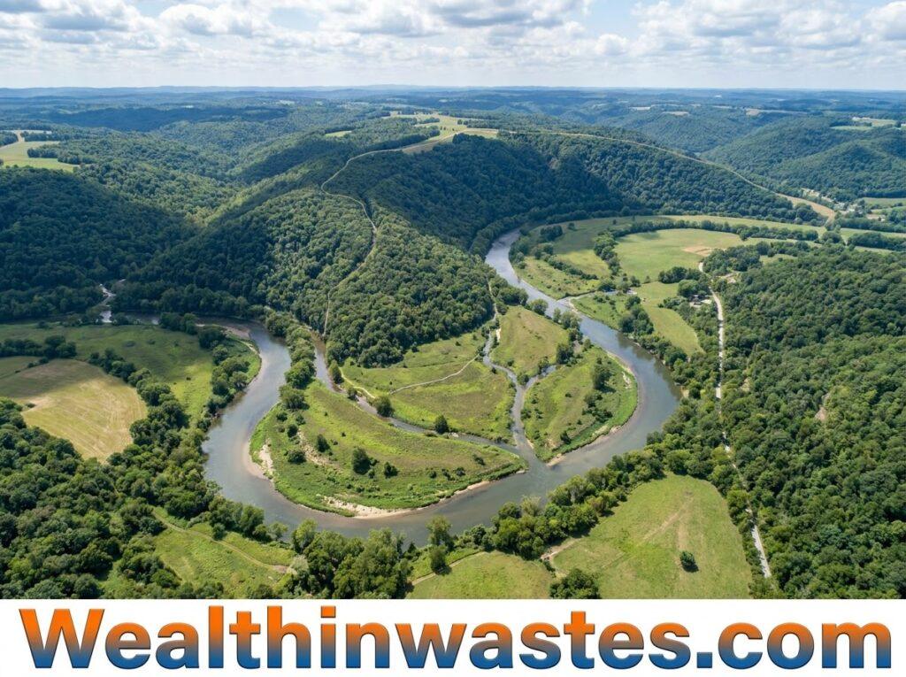
The most useful drainage-basin features describe its boundary, channel network, terrain, storage, and connections with surrounding systems. Together, they help explain how quickly water travels and where it accumulates during rainfall events.
1. Drainage Divide: This elevated boundary separates areas that feed different outlets. Hills, ridges, and mountain crests commonly form the divide, but broad, flat landscapes may require detailed elevation data to locate it accurately.
2. Stream Network: The network consists of the main river, its tributaries, and smaller channels that collect stream discharge and runoff from surrounding slopes. These connections direct water and sediment toward progressively larger streams within the basin.
3. Basin Area and Shape: Area describes the land contributing water to the outlet, while shape influences how quickly runoff arrives. Circular basins may concentrate flows faster than elongated basins under comparable conditions.
4. Relief and Channel Gradient: Relief describes elevation differences across the basin, while channel gradient indicates how steeply a stream descends. These characteristics influence flow velocity, erosion, sediment movement, and the development of channels.
5. Storage and Cover: Soil, vegetation, wetlands, ponds, and floodplains temporarily store water and slow its movement. These features support effective water-resource planning by influencing infiltration, groundwater recharge, and the timing of streamflow.
How Water Moves Through a Drainage Basin
Water enters a drainage basin mainly as precipitation, including rain and snow where relevant. Some water is intercepted by plants, while the remainder reaches the soil or land surface beneath vegetation.
Interception and surface depressions temporarily hold water, while evaporation returns some moisture to the atmosphere. The amount reaching the ground depends on rainfall intensity, vegetation, temperature, and surface conditions.
When the soil can absorb water, infiltration moves moisture into soil pores and may recharge groundwater. This process delays runoff and can sustain streamflow for longer periods between rainfall events.
Water that travels across the ground as overland flow can enter nearby channels quickly, particularly where rainfall exceeds infiltration capacity. Steep slopes, compacted soil, and paved surfaces can accelerate this movement.
Some infiltrated water moves sideways through the soil as throughflow, while deeper water can contribute to groundwater flow. These pathways often sustain rivers after rainfall stops, although their response times vary considerably.
Soil storage can become exhausted during prolonged wet weather, increasing runoff and saturation. Such conditions may contribute to irrigation-related soil damage where poor drainage prevents excess water from leaving agricultural fields.
Factors That Shape Drainage Basins
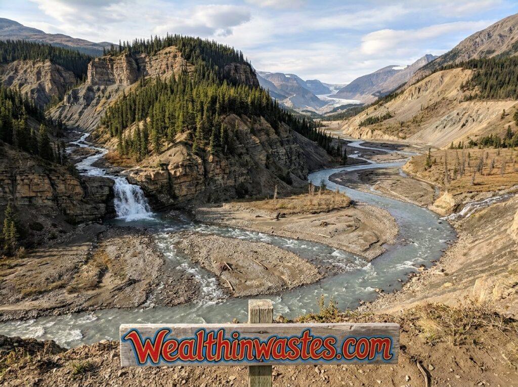
Drainage basins differ because natural conditions and human activities affect the way water enters, moves through, and leaves the landscape. These influences determine the basin’s runoff response, storage capacity, and channel development.
Understanding the following factors helps researchers compare catchments, assess environmental risks, and explain why similar rainfall events can produce different streamflow responses across neighbouring landscapes and seasons.
1. Topography and Slope: Steep slopes generally encourage faster surface movement, while gentler terrain may allow greater storage and infiltration. Rapid flows can increase topsoil loss when vegetation cover is limited.
2. Soil Type and Permeability: Sandy soils often allow faster infiltration than compact clay soils, although structure and moisture conditions also matter. Appropriate soil protection practices can improve water retention and reduce erosion.
3. Geology and Bedrock: Rock resistance, fractures, and underlying geological structures influence groundwater movement and channel direction. Resistant rock may preserve ridges, while weaker materials can erode more readily and alter the drainage network.
4. Climate and Rainfall: Rainfall amount, intensity, duration, and seasonal distribution control the water entering a basin. Temperature also affects evaporation and snowmelt, creating differences in streamflow between wet seasons and prolonged dry periods.
5. Vegetation and Land Use: Plant cover intercepts rainfall, protects soil, and influences infiltration. Deforestation, construction, and intensive cultivation can increase runoff, while changes in vegetation can affect biodiversity patterns across the catchment.
Major Drainage Basin Patterns
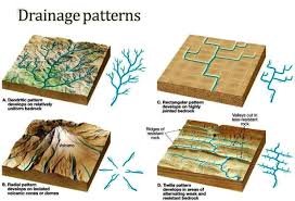
Drainage patterns describe the arrangement of stream channels across a basin. Their development reflects geological structures, slope, rock resistance, and surface conditions, making them useful clues for interpreting landscape history and drainage behaviour.
1. Trellis Drainage Pattern: This pattern develops where geological structures create alternating ridges and valleys. Main streams often follow the valleys, while smaller tributaries join them at approximately right angles across the landscape.
2. Rectangular Drainage Pattern: This pattern forms where joints and faults in bedrock guide channels along intersecting weaknesses. Streams frequently make sharp bends, creating a network with approximately right-angled connections between channel segments.
3. Parallel Drainage Pattern: This pattern commonly occurs on steep or uniformly sloping terrain, where many channels flow in broadly similar directions. Slope orientation and surface characteristics strongly influence the alignment of individual streams.
4. Dendritic Drainage Pattern: This tree-like network develops where underlying materials offer relatively uniform resistance to erosion. Numerous smaller tributaries join larger channels, transporting water and sediment toward the main river and downstream deposits.
5. Deranged Drainage Pattern: This poorly integrated network may develop in landscapes disturbed by glaciation or other major geological events. Irregular channels, lakes, and depressions complicate drainage until erosion and sediment movement gradually reorganise the landscape.
Why Drainage Basin Studies Matter
Drainage-basin studies connect land conditions with downstream water behaviour. By examining the whole catchment, researchers and planners can identify environmental pressures that isolated measurements of individual streams or land parcels might otherwise overlook.
1. Flood Risk Assessment: Basin size, slope, soil saturation, and land cover influence the amount and timing of runoff. These characteristics help specialists evaluate flood risk and identify locations requiring improved preparedness.
2. Water Quality Protection: Rainwater can carry fertilizers, pesticides, sewage, and other pollutants into streams. Basin-wide assessment helps explain freshwater quality and identify land-based sources that require monitoring, prevention, or treatment.
3. Aquatic Habitats and Biodiversity: Streams transport oxygen, nutrients, organic matter, and sediment that shape aquatic habitats. Healthy freshwater habitats support fish, invertebrates, plants, and other organisms that depend on stable water conditions.
4. Agriculture and Water Supply: Basin assessment helps farmers and planners understand seasonal water availability, drainage problems, and erosion hazards. It can guide irrigation planning, soil protection, and the location of water-storage facilities.
5. Ecosystem Conservation: Wetlands and floodplains store water, trap sediment, and provide habitats for wildlife. Protecting natural wetlands within a basin can preserve ecological functions and reduce some downstream environmental pressures.
Methods for Assessing Drainage Basins
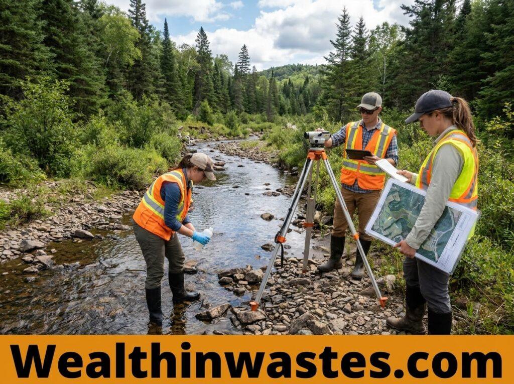
Researchers combine maps, field observations, flow records, and laboratory measurements to describe drainage-basin characteristics. The selected methods depend on the investigation’s objectives, the available equipment, and the size of the area.
Reliable assessments compare conditions across locations and seasons rather than relying on a single observation. Combining several methods provides a more complete picture of water movement, environmental quality, and catchment change.
1. Topographic Maps: Contour lines and elevation data help identify ridges, basin boundaries, stream channels, and outlet locations. Digital elevation models can also support basin-area calculations and channel-network mapping when their resolution suits the terrain.
2. Streamflow Measurements: Gauges record water levels, while discharge measurements estimate the volume passing a channel location over time. These records help researchers assess seasonal flow patterns, storm responses, and changes in water availability.
3. Field and Land-Cover Surveys: Investigators examine soil texture, rock type, vegetation, slope, erosion features, and land use. These observations explain why water moves differently between locations and help verify information obtained from maps.
4. Water Quality Testing: Sampling can measure turbidity, nutrients, dissolved oxygen, and other relevant indicators. Regular water-quality monitoring helps identify seasonal changes and potential pollution sources affecting rivers, lakes, and downstream users.
5. Sediment and Pollution Analysis: Researchers examine suspended particles, deposited materials, and pollutants in streams to understand transport pathways. Comparing samples collected upstream and downstream can help identify possible sources and affected areas.
Drainage Basin Management and Protection
Effective basin management protects water resources by addressing connected activities across the landscape. Farmers, communities, industries, and authorities must consider how decisions made upstream affect downstream water quality, habitats, and settlements.
1. Protect Vegetation: Maintaining vegetation along riverbanks and slopes helps stabilise soil, filter sediment, and provide habitat. Restoring degraded areas can reduce surface erosion and improve the resilience of streams during heavy rainfall.
2. Control Soil Erosion: Contour farming, cover crops, mulching, and appropriately designed terraces reduce soil movement on vulnerable land. These measures limit sediment entering channels and help preserve fertile topsoil for continued agricultural production.
3. Manage Land Development: Careful planning can protect floodplains, maintain drainage pathways, and limit excessive paved surfaces. Retention ponds, permeable surfaces, and suitable drainage systems can help slow urban runoff before it reaches streams.
4. Prevent Water Pollution: Proper waste disposal, responsible chemical application, and adequate wastewater treatment reduce contaminants entering waterways. Strong pollution prevention practices protect aquatic ecosystems and preserve water supplies for domestic, agricultural, and industrial uses.
5. Coordinate Basin-Wide Action: Neighbouring communities and authorities should share information, monitor environmental changes, and coordinate conservation measures. This approach supports environmental protection because water and pollutants often move beyond administrative boundaries.
Read Also: Integrated Watershed Management and Importance of Watersheds
Summary on Meaning, Features and Patterns of Drainage Basin
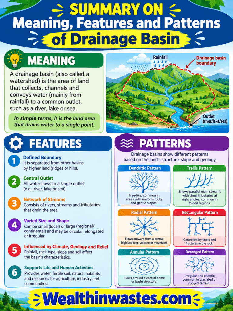
| Aspect | Summary |
|---|---|
| Definition | An area of land that directs water toward a common stream, river, lake, or other outlet. |
| Boundary | A drainage divide separates adjacent surface drainage areas. |
| Water movement | Water moves through interception, infiltration, surface runoff, throughflow, groundwater flow, and stream discharge. |
| Main characteristics | Area, shape, relief, channel gradient, soil, geology, vegetation, and land use. |
| Drainage patterns | Trellis, rectangular, parallel, dendritic, and deranged. |
| Importance | Supports flood assessment, water management, habitat conservation, and pollution control. |
| Protection | Vegetation conservation, erosion control, responsible land use, pollution prevention, and coordinated management. |
Frequently Asked Questions About Drainage Basin: Meaning, Features, Importance and Patterns
1. What Is a Drainage Basin?
A drainage basin is a land area that collects precipitation and directs water through surface and underground pathways toward a common outlet, such as a river, stream, lake, or wetland.
2. What Is a Drainage Divide?
A drainage divide is a topographic boundary, often following ridges or high ground, that separates neighbouring drainage basins and directs surface water toward different river systems or outlets.
3. What Are the Five Major Drainage Patterns?
The five major patterns discussed here are trellis, rectangular, parallel, dendritic, and deranged. Each pattern reflects the influence of geology, terrain, slope, and other environmental conditions on channel development.
4. Which Factors Affect Drainage Basin Behaviour?
Topography, soil properties, geology, climate, vegetation, and human land use influence infiltration, runoff, storage, channel formation, sediment transport, and the timing and volume of water reaching the basin outlet.
5. Why Are Drainage Basins Important?
Drainage basins help researchers understand water availability, predict flood behaviour, investigate pollution, estimate sediment transport, protect aquatic habitats, and plan sustainable management of connected land and water resources.
6. How Can a Drainage Basin Be Protected?
Protection involves maintaining vegetation, controlling soil erosion, managing development, preventing water pollution, protecting wetlands, and coordinating conservation activities among communities and authorities throughout the catchment.
Do you have any questions, suggestions, or contributions? If so, please feel free to use the comment box below to share your thoughts. We also encourage you to kindly share this information with others who might benefit from it. Since we can’t reach everyone at once, we truly appreciate your help in spreading the word. Thank you very much for your support and for sharing!
Read Also: Components and Functions of a Watershed in Agricultural Systems