


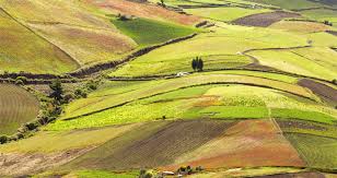
Land distribution describes how the world’s terrestrial area is spread among forests, croplands, grasslands, settlements, deserts, wetlands, and other uses across different regions and countries.
Global land resources support agriculture, forestry, biodiversity, settlements, infrastructure, water systems, and many economic activities, making careful allocation essential for environmental stability and human development.
Although cultivated land occupies a relatively small share of the planet, much economically accessible land already supports valuable ecological or productive functions, limiting opportunities for expansion.
Land suitability also varies considerably because climate, soil, terrain, water availability, vegetation, technology, and human management determine which uses can remain productive and sustainable.
Understanding global land distribution therefore helps explain differences in agricultural productivity, resource pressure, food security, environmental degradation, and opportunities for sustainable development among regions.
Global Land Distribution and Major Uses
The global land area covers about 13.2 billion hectares, with major portions supporting cultivation, forests, grasslands, woodlands, settlements, infrastructure, and other ecological functions across diverse environments.
According to the supplied FAO figures, agricultural crops occupy about 12 percent, forests cover 28 percent, while grasslands and woodland ecosystems account for approximately 35 percent globally.
These broad categories reveal that agriculture occupies less land than natural ecosystems, yet cultivated areas often occur where soils, rainfall, terrain, transport, and markets make production economically attractive.
Regional land distribution patterns reflect climatic conditions, population density, economic development, historical settlement, and technology, producing distinct landscapes across continents and within individual countries.
1. Cropland: Cropland occupies a significant share of land in South and Southeast Asia, Western and Central Europe, Central America, and the Caribbean, where intensive agriculture supports large populations.
2. Forests: Forests dominate extensive tropical, northern, and temperate areas, providing timber, carbon storage, wildlife habitat, water regulation, biodiversity, and important ecosystem services for human communities.
3. Grasslands: Grasslands and woodlands support livestock production, wildlife, biodiversity, soil protection, and pastoral livelihoods, particularly across regions where rainfall or temperature limits intensive crop cultivation.
4. Deserts: Deserts occupy extensive areas across northern Africa and parts of Asia, where low rainfall, high evaporation, and limited soil moisture restrict conventional agricultural development.
For additional background, the concept of land includes soil, terrain, climate, water, vegetation, wildlife, groundwater, and human-made features, as explained in land resource classifications and land-use concepts.
Read Also: Top Wastewater Management Companies in the World
Land Suitability Across World Regions
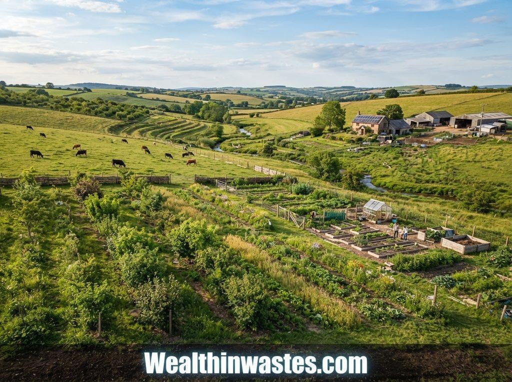
Land suitability refers to the capacity of a particular area to support a specified use sustainably while achieving realistic production levels under suitable technologies, management systems, and environmental conditions.
Suitability assessments consider soil depth, fertility, drainage, temperature, rainfall, terrain, water availability, erosion risks, and other environmental characteristics that influence agricultural performance.
Currently cultivated land includes substantial areas considered prime or good quality, although the proportion of prime land differs considerably between high-income and low-income regions.
1. Prime Land: Prime agricultural land possesses favourable physical and environmental conditions that allow crops to achieve high attainable yields with comparatively fewer limitations.
2. Good Land: Good agricultural land can support profitable crop production but may contain moderate limitations involving fertility, moisture, terrain, drainage, or climate.
3. Marginal Land: Marginal areas face stronger limitations that can increase production costs, environmental risks, or dependence on technologies such as irrigation, drainage, fertilization, or soil conservation.
4. Unsuitable Land: Land with severe climatic, soil, terrain, drainage, or water limitations may not support profitable conventional crop production without excessive investment or environmental damage.
Understanding soil properties is therefore essential when assessing agricultural suitability, and farmers can learn more from soil erosion processes and their effects on productive land.
Similarly, choosing land for different uses requires attention to environmental conditions, particularly where development could create contamination or resource-management problems.
Factors That Shape Land Use
Several interacting factors determine how societies distribute and use available land, with natural conditions establishing basic possibilities while population, markets, infrastructure, policies, and technology influence actual decisions.
Climate strongly influences crop choice, vegetation patterns, grazing potential, and irrigation demand because temperature and rainfall determine growing seasons, water availability, and production risks.
Soil characteristics also matter because texture, depth, fertility, organic matter, drainage, acidity, and water-holding capacity determine whether particular crops can perform sustainably.
Topography affects mechanization, erosion, drainage, construction costs, and accessibility, making flat or gently sloping areas generally easier to cultivate and develop than steep terrain.
Population growth and urban expansion increase competition among agriculture, housing, industry, transportation, recreation, and conservation, creating difficult choices where accessible land remains limited.
Land ownership and tenure arrangements can also influence investment, productivity, conservation, and access because farmers are more likely to manage resources carefully when rights remain predictable.
These issues are explored further through resource conservation and competing land-use pressures, where economic activities and ecological priorities may conflict.
Disposal activities also require careful site selection, since geology, soil, topography, groundwater, hydrology, climate, infrastructure, and accessibility can determine whether a location remains environmentally suitable.
For this reason, environmental factors affecting suitable disposal sites provide useful lessons about how physical land characteristics can determine appropriate land-use decisions.
Land Resources in Rainfed Agriculture
Rainfed agriculture remains the predominant production system worldwide, particularly across highlands, dry tropics, humid tropics, and regions where farmers depend directly upon seasonal rainfall.
Smallholder farmers dominate many rainfed systems, often operating with limited access to irrigation, improved inputs, finance, machinery, extension services, insurance, and reliable markets.
Soil nutrient availability may remain low in many rainfed areas, while sloping landscapes and intense rainfall can accelerate erosion when vegetation cover and soil management become inadequate.
High temperatures combined with low or irregular rainfall frequently create soil-moisture shortages, especially where farmers lack affordable technologies for water harvesting, storage, supplemental irrigation, or moisture conservation.
Farmers can reduce these pressures through better soil management, vegetation protection, appropriate cropping systems, and conservation practices that improve water retention and reduce runoff.
Effective soil conservation methods include practices discussed under soil conservation and renewable resource management, particularly techniques that reduce erosion and maintain productive soil structure.
Protecting rainfed land becomes especially important because degradation reduces productivity, increases vulnerability to climatic shocks, and can deepen food insecurity among resource-poor farming households.
Rainfed Productivity and Production Gaps
Rainfed agricultural productivity measures how much agricultural output farmers obtain from each unit of cultivated land under rainfall-dependent production conditions and available management systems.
Productivity varies enormously because soil and water conditions interact with technology, improved seeds, fertilizer access, machinery, extension services, market opportunities, prices, finance, and farmer knowledge.
In many sub-Saharan African farming systems, historical production increases have relied heavily on expanding cultivated areas rather than achieving sustained yield improvements from existing land.
By contrast, Latin American and Caribbean farming systems have recorded substantial yield growth for important rainfed crops, demonstrating the potential value of better technology and management.
European wheat production also illustrates how improved varieties, nutrient management, mechanization, plant protection, and other agricultural technologies can substantially increase output without proportionally expanding cultivated land.
Reducing production gaps requires investments that fit local conditions rather than simply transferring technologies without considering farmers’ financial capacity, environmental constraints, infrastructure, and market incentives.
Maintaining soil fertility remains central to closing productivity gaps, making organic waste composting for soil improvement particularly valuable where organic materials are readily available.
Farmers can also benefit from understanding productive uses of agricultural wastes, which can convert crop residues and animal wastes into useful soil amendments and farm resources.
Land and Water Resources in Irrigated Agriculture
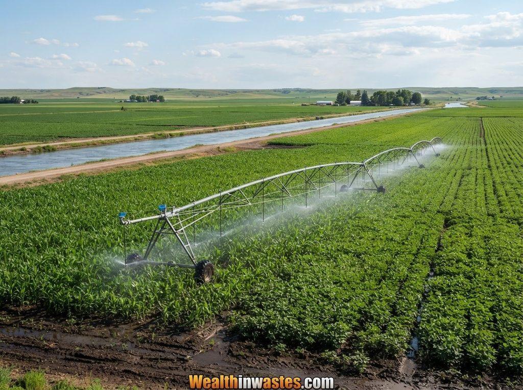
Irrigated agriculture gives farmers greater control over water supply, allowing crop production to continue during rainfall shortages and supporting higher yields where management remains effective.
Irrigation has contributed significantly to agricultural production, rural incomes, and food supplies, especially in regions where seasonal rainfall patterns create substantial production uncertainty.
However, irrigation does not automatically guarantee sustainable production because poorly managed systems can waste water, degrade soils, increase salinity, and place pressure on groundwater resources.
Groundwater provides a readily accessible source for irrigation, yet excessive abstraction can lower groundwater levels and threaten long-term water availability in vulnerable aquifers.
Efficient water management therefore requires accurate scheduling, suitable irrigation methods, drainage, soil monitoring, maintenance, and careful consideration of water quality.
Farmers and planners can strengthen water management by studying water resource protection and development practices, particularly approaches that reduce contamination and protect available sources.
Water quality also matters because polluted irrigation water can damage soils, crops, livestock, aquatic ecosystems, and human health, especially when contaminants accumulate through repeated agricultural use.
Good water-quality planning should therefore draw upon water quality management principles and water pollution source classifications when assessing irrigation risks.
Challenges Affecting Land Distribution and Use
Land resources face growing pressure from population growth, agricultural expansion, urbanization, infrastructure development, resource extraction, pollution, climate change, and competing economic interests.
Land degradation can reduce soil productivity, weaken ecosystems, increase erosion, reduce water quality, and force farmers to seek additional land to maintain production.
Deforestation can remove vegetation that protects soil while also reducing habitats, disrupting biodiversity, changing water cycles, and weakening ecosystem services important to rural communities.
Climate change adds further uncertainty because droughts, floods, temperature changes, and altered rainfall patterns can directly affect agricultural production and indirectly increase degradation pressures.
These pressures are discussed in greater detail through climate change impacts on land resources and agricultural production, particularly where changing conditions increase risks for vulnerable farming systems.
Pollution creates another challenge because hazardous substances can contaminate land, groundwater, crops, livestock, and ecosystems, reducing the suitability of affected areas for productive uses.
Agricultural wastes also require responsible handling because inappropriate disposal can create environmental problems, as explained in agricultural waste generation and characteristics.
Similarly, agricultural waste impacts on humans and the environment demonstrate why waste reduction, recycling, recovery, composting, and safe disposal should accompany intensive land use.
Read Also: Strategies for Reducing Water Pollution
Sustainable Strategies for Better Land Use

Sustainable land management seeks to balance agricultural production, economic development, ecosystem protection, biodiversity, and long-term resource availability without undermining future generations’ opportunities.
Improved land productivity can reduce pressure for agricultural expansion by increasing output from existing farms while protecting forests, grasslands, wetlands, and other valuable ecosystems.
1. Soil Conservation: Contour farming, terracing, strip cropping, mulching, minimum tillage, cover crops, and suitable vegetation can reduce erosion while protecting soil structure and fertility.
2. Efficient Irrigation: Better irrigation scheduling, suitable application methods, drainage, water monitoring, and maintenance can increase water productivity while reducing waste, salinity, and groundwater depletion.
3. Organic Resource Recycling: Composting and responsible agricultural waste recovery return useful organic matter to soils while reducing disposal problems and creating additional opportunities for farm resource efficiency.
4. Integrated Planning: Land-use planning should coordinate agriculture, settlements, forests, conservation areas, infrastructure, water resources, and other activities according to local environmental and socioeconomic conditions.
Responsible waste management can support sustainable land use because uncontrolled disposal occupies land and introduces pollutants, whereas recovery systems can return materials to productive economic cycles.
Useful examples include agricultural waste management practices that treat residues as resources for compost, fertilizer, energy, animal feed, and other beneficial applications.
Recycling can extend these benefits through agricultural waste recycling opportunities, creating useful products while reducing the amount of material requiring final disposal.
Communities can also explore composting systems for biodegradable materials to improve soil health while reducing the environmental burden associated with unmanaged organic waste.
Effective sustainability also requires cooperation among governments, farmers, landowners, businesses, researchers, conservation organizations, and local communities because land decisions affect multiple users simultaneously.
Conservation approaches should therefore recognize ecological limits while supporting livelihoods, particularly where communities depend directly upon agriculture, grazing, forestry, fisheries, and other natural resources.
Good land management can also consider the economic consequences of environmental degradation, including losses affecting agriculture, natural resources, infrastructure, health, and community livelihoods.
These economic dimensions are highlighted by economic losses resulting from pollution, showing why preventing environmental damage often provides stronger long-term benefits than paying for restoration afterward.
Effective land-use planning must finally recognize that productive land, forests, grasslands, wetlands, and water resources provide interconnected services that cannot always be replaced once degraded.
Summary on Land Distribution, Use and Suitability Worldwide
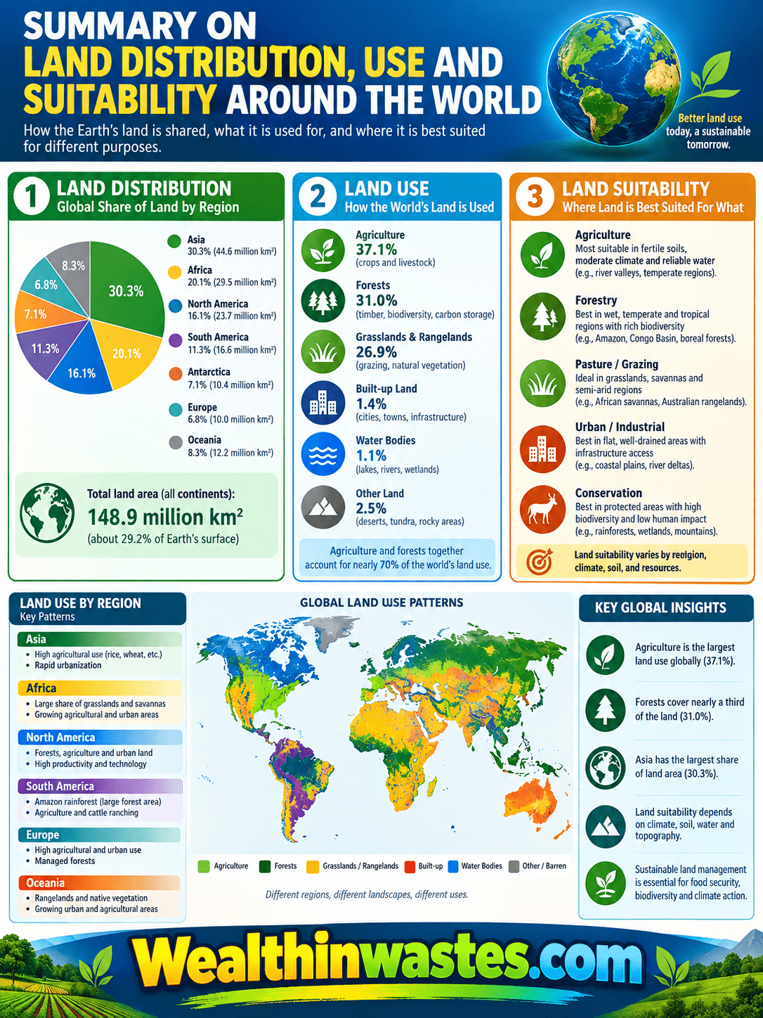
| Topic | Summary |
|---|---|
| Global Land Distribution | Land is divided among cropland, forests, grasslands, woodlands, deserts, settlements, infrastructure, wetlands, and other ecosystems. |
| Land Suitability | Suitability depends on soil, climate, terrain, water availability, drainage, management, technology, and environmental limitations. |
| Rainfed Agriculture | Rainfed farming dominates globally and often faces rainfall uncertainty, soil nutrient limitations, erosion, and moisture shortages. |
| Productivity Gaps | Technology, inputs, finance, markets, management, and infrastructure strongly influence agricultural yields and production efficiency. |
| Irrigated Agriculture | Irrigation improves water control and production but requires efficient management to prevent salinity, groundwater depletion, and pollution. |
| Land-Use Challenges | Population growth, urbanization, pollution, climate change, deforestation, degradation, and competing land demands increase resource pressure. |
| Sustainable Management | Soil conservation, efficient irrigation, recycling, integrated planning, biodiversity protection, and responsible resource management support long-term land productivity. |
Frequently Asked Questions About Land Distribution, Use and Suitability Worldwide
1. What does land distribution mean?
Land distribution describes how available terrestrial areas are allocated among agriculture, forests, grasslands, settlements, conservation, infrastructure, deserts, wetlands, and other human or ecological uses.
2. What determines land suitability?
Land suitability depends mainly on climate, soil properties, terrain, drainage, water availability, fertility, environmental limitations, technology, management practices, and the requirements of specific land uses.
3. Why is land distribution unequal worldwide?
Land distribution differs because countries have different climates, terrains, soils, population densities, natural ecosystems, economic structures, historical settlement patterns, technologies, and resource-management systems.
4. What is rainfed agriculture?
Rainfed agriculture relies mainly on natural rainfall rather than controlled irrigation, making crop production particularly sensitive to rainfall timing, drought, seasonal variability, soil moisture, and climatic conditions.
5. Why is irrigated agriculture important?
Irrigation provides greater control over water supply, helping farmers maintain production during rainfall shortages and potentially increasing yields where systems receive suitable management and maintenance.
6. What threatens sustainable land use?
Major threats include land degradation, erosion, pollution, deforestation, overgrazing, urban expansion, climate change, excessive water extraction, inappropriate cultivation, and poorly planned development.
7. How can land productivity improve without expansion?
Productivity can improve through better soil management, improved inputs, suitable technologies, efficient irrigation, stronger extension services, appropriate crop varieties, better infrastructure, and improved market access.
8. Why should land resources be conserved?
Conservation protects soil, water, biodiversity, productive capacity, ecosystem services, livelihoods, and future development opportunities while reducing the economic and environmental costs associated with resource degradation.
[Do you have any questions, suggestions, or contributions? If so, please feel free to use the comment box below to share your thoughts. We also encourage you to kindly share this information with others who might benefit from it. Since we can’t reach everyone at once, we truly appreciate your help in spreading the word. Thank you very much for your support and for sharing!]