


Soil scientists have long differed over the most suitable traditional approach for classifying soils, especially because soils vary widely in properties, formation, environment, and levels of development across landscapes and regions.
Integrative Soil Classification Systems respond to these differences by combining useful features from several approaches, allowing scientists to arrange soils within hierarchical categories that support clearer comparison, communication, and practical identification.
Instead of examining isolated characteristics alone, integrative approaches connect observable soil properties with diagnostic horizons, morphology, developmental patterns, environmental conditions, and broader relationships among recognized soil groups across landscapes worldwide.
This approach creates an upward assemblage that can move from specific soil series toward broader soil orders or classes, making classification useful for research, mapping, agriculture, land evaluation, and resource planning.
This article focuses mainly on the USDA Seventh Approximation and the FAO system, explaining their principles, categories, diagnostic criteria, major groups, advantages, limitations, and practical relevance to soil studies and management.
Integrative Classification of Soils
Integrative classification emerged because no single traditional system satisfied every soil scientist or every purpose. The approach brings selected classification principles together, producing a more holistic framework for identifying, grouping, and comparing soils.
The central idea is hierarchy. A classification may begin with detailed soil properties and series, then move upward through broader categories such as families, subgroups, great groups, suborders, and orders.
This structure helps researchers describe soils consistently without depending entirely on assumptions about their origin. The system can emphasize measurable morphology and diagnostic features while still recognizing important environmental and formative relationships across landscapes.
The broader discussion of earlier classification approaches shows why integrative methods gained importance when different disciplines used contrasting criteria for organizing the world’s complex range of soils over time today.
A strong pedological perspective also helps explain why classification considers soil appearance, formation, composition, distribution, management, and relationships with other branches of environmental and agricultural science worldwide in practice where needed.
Because soils change across landscapes, an integrative hierarchy helps researchers relate local descriptions to wider categories without forcing every site into an isolated or completely unrelated classification framework within large regional datasets.
The approach therefore serves as a communication tool as well as a scientific system. Shared categories allow soil scientists, agricultural specialists, and environmental managers to compare observations more efficiently across regions.
Read Also: The Science of Pedology and Functions of Soil
USDA Seventh Approximation System

1. Development And Basis: The USDA developed the Seventh Approximation in 1974. The system relies strongly on soil morphology, especially recognizable diagnostic horizons that reflect dominant soil-forming processes, environmental conditions, and measurable profile characteristics.
2. Hierarchical Organization: The system arranges soils through six categories, moving from Order, Suborder, Great Group, and Subgroup to Family and Series, with Order broadest and Series most specific within the hierarchy.
3. Property-Based Identification: Classification focuses on measurable soil properties rather than requiring complete knowledge of genesis. This allows researchers to classify soils whose formation history remains uncertain, including patterns discussed in complex soil-forming processes.
4. Scientific Uniformity: The framework encourages greater consistency among soil researchers because clearly defined properties provide shared criteria for classification, comparison, description, mapping, and communication across different study areas and research programs.
5. Broader Soil Assessment: The system concentrates attention on the soil itself, while detailed physical profile characteristics support clearly useful distinctions involving texture, structure, colour, depth, temperature, and horizon development.
6. Practical Flexibility: The system can classify soils even when their genesis remains uncertain, because measurable properties provide the evidence needed for placement within the appropriate taxonomic category for consistent field classification.
Twelve Soil Orders In USDA Taxonomy

1. Gelisols, Histosols, Spodosols: Gelisols contain permafrost within two metres. Histosols have thick organic surface layers. Spodosols are acidic forest soils with subsurface accumulations of iron and aluminium oxides, fitting broader genetic soil groupings.
2. Andisols, Oxisols, Vertisols: Andisols develop in volcanic ash. Oxisols are intensely weathered tropical or subtropical soils. Vertisols are dark clay soils with strong shrink-swell behaviour, useful for agricultural land suitability assessment.
3. Aridisols, Ultisols, Mollisols: Aridisols occur in arid environments. Ultisols are strongly leached with clay accumulation and low base saturation. Mollisols have dark, base-rich surface horizons, often under grassland vegetation.
4. Alfisols, Inceptisols, Entisols: Alfisols show clay accumulation and relatively higher base saturation. Inceptisols are young, weakly developed soils. Entisols have little or no profile development and limited horizon differentiation.
5. Hierarchical Levels: Order remains the broadest category in the USDA framework, while Series provides the most specific level. The intermediate levels progressively increase detail and classification precision for practical soil description.
FAO Soil Classification Framework
The FAO developed a supra-national soil classification intended to provide broad, internationally useful generalizations about soil development and relationships with major soil-forming factors across different parts of the world worldwide.
The system first appeared through the UNESCO Soil Map of the World in 1974, using a continental-scale mapping framework at a scale of 1 to 5 million and relying on diagnostic horizons for class separation.
Its criteria include soil phases, textural classes, and slope classes. These criteria supported the identification of 106 Soil Units, which were mapped as Soil Associations and grouped into broader World Soil Classes.
The FAO framework remains especially useful where scientists need a common international language for describing soils from different countries. Its broad scope supports comparison even when local classification systems differ significantly.
For detailed field understanding, basic soil properties and soil moisture assessment remain important because the FAO system depends strongly on descriptions that distinguish diagnostic characteristics across varied environments in practice.
The FAO approach can accommodate many soils using field descriptions, which makes it especially useful where detailed laboratory information is unavailable. Its broad categories also encourage communication among countries with different national systems.
However, the framework is not designed to provide the finest local distinctions. Users should therefore understand its continental emphasis and recognize that national or local systems may offer greater detail for specific management decisions.
FAO World Soil Classes And Criteria
1. Diagnostic Horizons: FAO separates soil classes using identifiable diagnostic horizons, helping distinguish broad soil groups through observable profile characteristics rather than relying only on assumed geographic origin or genetic history.
2. Soil Phases: Soil phases form one major criterion in the framework. They help recognize important variations within broader soil units and support more detailed description during soil resource management exercises.
3. Texture And Slope: Textural classes and slope classes complement soil phases, helping characterize land conditions that affect drainage, erosion risks, water movement, field interpretation, and practical soil mapping across varied landscapes.
4. Twenty-Six Classes: The source identifies 26 and lists Chernozems, Arenosols, Cambisols, Ferrasols, Fluvisols, Gleysols, Greyzems, Histosols, Kastanozems, Lithosols, Luvisols, Nitosols, Phaeozems, Planosols, Podzols, Podzoluvisols, Rankers, Regosols, Rendzinas, Solonchaks, Solonetz, Vertisols, Xerosols, and Yermosols.
5. International Scale: The framework works best at continental scale rather than local detail. Its strength lies in international coverage, although the source notes that the system is not ideal for every purpose.
6. Mapping Function: The broad classes make regional patterns easier to portray on international maps, while the underlying Soil Units provide more detailed information for interpreting soil variation within mapped associations and landscapes.
Value Of Integrative Soil Classification Systems
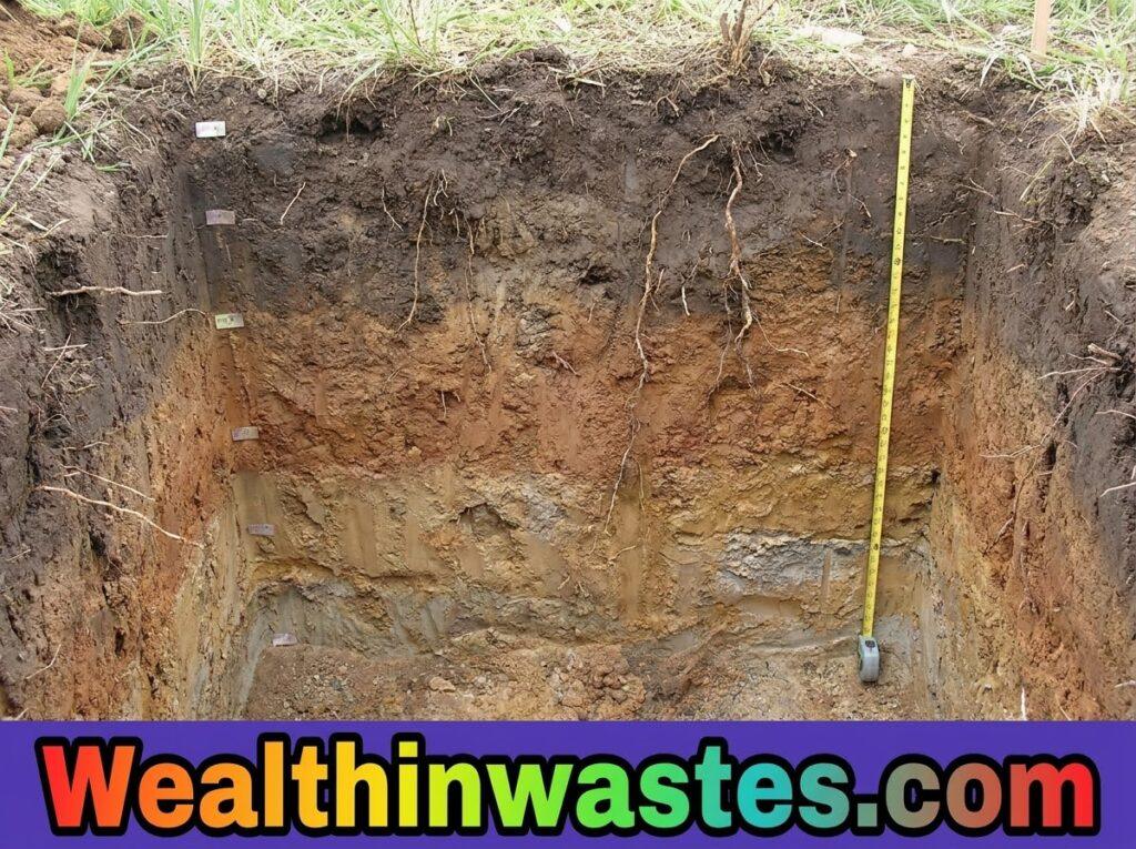
Integrative systems offer a practical bridge between detailed soil description and broad regional understanding. They help scientists communicate soil information using categories that remain meaningful across studies, maps, and management decisions.
Their value also depends on understanding measurable soil characteristics. Knowledge of the four soil constituents helps explain differences in mineral matter, organic matter, soil air, and soil water that influence profile behavior.
Classification can support environmental planning because soil groups often differ in drainage, weathering, fertility, and response to disturbance. Such information strengthens soil conservation measures and land-management choices for farmers and communities.
It can also provide a framework for interpreting vulnerability. Areas with particular soil properties may respond differently to erosion, chemicals, or poor land use, making land pollution assessment more context-sensitive.
These strengths do not mean one classification system answers every question. Local surveys, laboratory tests, land evaluation, and field observations remain necessary when decisions require detailed site-specific information and management recommendations.
Consistent categories also improve data exchange among institutions. When researchers describe soils using recognized taxonomic levels, information from separate surveys can be compared more easily and combined for broader environmental analysis.
The value extends to planning because classification can highlight contrasts among soils before managers choose interventions. It provides an organized starting point for evaluating constraints, opportunities, conservation needs, and productive uses.
USDA And FAO Systems Compared
1. Geographic Scope: USDA provides a detailed hierarchical system suited to systematic soil classification, while FAO offers a broader international framework designed for comparison and mapping across continents and countries.
2. Main Emphasis: USDA strongly emphasizes morphology and diagnostic properties within a hierarchical taxonomy. FAO emphasizes broad international groupings based on diagnostic horizons, phases, texture, slope, and mapping requirements at different scales.
3. Category Structure: USDA uses six hierarchical levels from Order to Series. FAO groups Soil Units into broader World Soil Classes, creating a framework that supports international communication across different national systems.
4. Practical Detail: USDA generally permits more detailed classification at lower levels, while FAO supports generalized continental interpretation. Both approaches benefit from environmental media knowledge during field assessment and regional planning.
5. Management Relevance: Both systems can inform agricultural and environmental interpretation, but users should combine classification with local evidence, including soil moisture controls and hazardous soil concerns, climate, land use, and field observations.
6. Complementary Role: The two systems should not be treated as competitors for every purpose. Their different scales and structures can complement one another when researchers combine detailed taxonomy with broad international soil comparisons.
Read Also: Traditional Soil Classification Systems
Agricultural Use Of Integrative Soil Classification Systems

Integrative soil classification has practical value in agriculture because farmers and planners need to understand how different soils behave before selecting crops, drainage strategies, conservation practices, and suitable management systems.
Classification can help connect soil properties with expected field behavior. For example, differences in texture, drainage, horizon development, and weathering can influence rooting conditions, water retention, nutrient management, and erosion sensitivity.
Chemical movement also varies with soil characteristics. Understanding soil property interactions helps explain why pesticides may remain near application areas or move through soil under different conditions and rainfall patterns.
Environmental risks require similar attention. Soil groups can differ in how contaminants travel, accumulate, or persist, so studies of toxicant mobility should consider texture, organic matter, moisture, and chemical properties together.
Environmental risks require similar attention. Soil groups can differ in how contaminants travel, accumulate, or persist, so studies of contamination concerns should consider texture, organic matter, moisture, and chemical properties together.
Finally, classification can inform broader land degradation assessments by identifying differences among soil groups and helping managers match conservation, restoration, and productive land-use choices to local soil conditions and priorities.
Soil classification should also connect with field survey work. Careful profile observation and laboratory testing can confirm whether a mapped classification adequately represents the actual conditions encountered within a farm or landscape.
Local farming context matters as well. Climate, cropping history, drainage, inputs, slope, and farmer practices can alter soil performance, so classification should guide decisions rather than replace site-specific agricultural judgment.
Summary on Integrative Soil Classification Systems
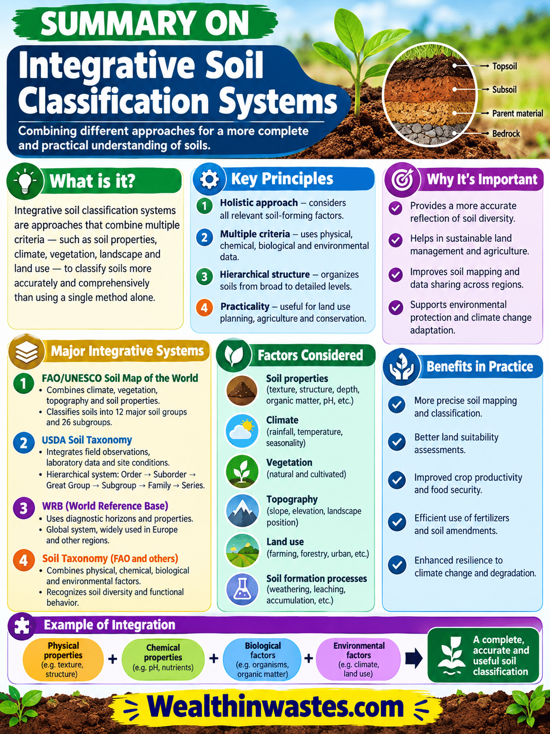
| Aspect | USDA Seventh Approximation | FAO Classification |
|---|---|---|
| Main Purpose | Detailed hierarchical soil classification | Broad international soil comparison and mapping |
| Main Basis | Morphology and diagnostic horizons | Diagnostic horizons, phases, texture, and slope |
| Hierarchy | Order, Suborder, Great Group, Subgroup, Family, Series | Soil Units and broader World Soil Classes |
| Major Grouping | 12 Soil Orders | 26 World Soil Classes identified by the source |
| Scale | Detailed classification | Continental and international scale |
| Main Strength | Consistency and detailed taxonomic organization | International applicability and broad comparison |
| Agricultural Value | Supports soil identification and management interpretation | Supports regional soil understanding and land planning |
Frequently Asked Questions About Integrative Soil Classification Systems: USDA and FAO Guide
1. What are Integrative Soil Classification Systems?
Integrative Soil Classification Systems combine useful principles from traditional approaches and arrange soil characteristics within hierarchical groups, creating a broader framework for consistent identification, comparison, mapping, and environmental or agricultural interpretation.
2. How does USDA Seventh Approximation classify soil?
The USDA Seventh Approximation is based strongly on soil morphology and diagnostic horizons, then organizes soils through Order, Suborder, Great Group, Subgroup, Family, and Series as progressively more specific classification levels.
3. What are the twelve USDA Soil Orders?
The USDA source recognizes twelve major Soil Orders: Gelisols, Histosols, Spodosols, Andisols, Oxisols, Vertisols, Aridisols, Ultisols, Mollisols, Alfisols, Inceptisols, and Entisols within the Seventh Approximation framework for systematic soil identification and mapping.
4. What is FAO Soil Classification used for?
The FAO system provides a supra-national framework intended mainly for broad international comparison and mapping. It uses diagnostic horizons, soil phases, textural classes, and slope classes to organize World Soil Classes.
5. Can these systems support agricultural planning?
Yes. Classification supports agricultural planning by improving understanding of soil properties, drainage, texture, horizon development, weathering, and environmental limitations that influence land management, conservation, cropping decisions, and resource assessment for sustainable production.
6. Should classification replace local soil testing?
Neither system should replace detailed local investigation. Field observations, soil surveys, laboratory testing, land evaluation, and site-specific evidence remain necessary when decisions require precise information about soil behavior and management.
Do you have any questions, suggestions, or contributions? If so, please feel free to use the comment box below to share your thoughts. We also encourage you to kindly share this information with others who might benefit from it. Since we can’t reach everyone at once, we truly appreciate your help in spreading the word. Thank you very much for your support and for sharing!
Read Also: Understanding Soil Classification in Nigerian Agriculture