


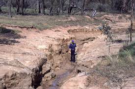
Water resources development depends on healthy land and reliable water supplies. Erosion, flooding and sediment movement can damage rivers, reservoirs, farms, roads and communities when land and drainage systems receive poor management.
Rainfall naturally reshapes landscapes, but rapid vegetation removal, poorly planned construction, excessive cultivation and blocked drains can accelerate these processes. The results include lost topsoil, polluted waterways, reduced storage capacity and unsafe settlements.
For farmers, sediment in irrigation canals can interrupt water delivery, while eroded fields lose nutrients and organic matter. Communities may face damaged roads, contaminated supplies and repeated flood losses after heavy storms.
Effective water resources development therefore links land protection, flood-risk reduction, sediment management and community planning. These measures help maintain water quality, protect infrastructure and improve the reliability of supplies for homes, farms and industries.
This article explains the meaning and agents of erosion, the main causes of flooding, the problems sediment creates, and practical methods communities can use to protect water resources over time.
Erosion and Water Resources Development
Erosion is the wearing away, removal and movement of soil or rock by water, wind, ice and other natural forces. Unlike weathering, erosion carries loosened material away from its original location.
Weathering breaks down rocks through physical, chemical or biological processes. Erosion then transports loose materials to other locations, where they may settle in rivers, valleys, lakes, reservoirs or coastal environments.
Erosion plays an important natural role by forming landscapes and supplying sediments to rivers, floodplains and coastal areas. However, intensive land disturbance can increase losses beyond the soil’s natural recovery rate and weaken the landscape.
Protecting soil and mineral resources requires careful land management because productive soil supports vegetation, regulates water movement and contributes to healthy catchments. Excessive erosion undermines these functions and reduces agricultural productivity.
Sustainable water management considers the connection between hillslopes, vegetation, streams, groundwater and reservoirs. Good water resource planning must therefore reduce erosion before sediment reaches infrastructure and supplies used by local communities.
Read Also: Soil Erosion: Meaning, Types and Factors of Soil Erosion
Main Agents of Erosion and Sediment Movement

Natural agents remove soil and rock from their original positions and transport the resulting materials elsewhere. The principal agents include running water, wind, groundwater, glaciers and marine processes, although their importance varies between environments.
1. Running Water: Running water causes substantial erosion when rapid runoff carries loose particles into channels. As flow speed and volume rise, water scours riverbanks, deepens channels and transports larger sediment loads downstream.
2. Wind: Wind removes dry, unprotected soil, especially from bare fields and semi-arid land. Blown sand also abrades exposed rock, while dust travels long distances and settles in rivers, reservoirs and irrigation channels.
3. Groundwater: Groundwater erodes soluble rocks beneath the surface as slightly acidic water dissolves minerals and carries them through cracks. Over time, this process can create cavities, sinkholes and unstable ground in susceptible areas.
4. Glaciers: Glaciers erode landscapes when moving ice collects rock fragments and drags them over bedrock. This powerful action scratches, grinds and transports debris, although glaciers have limited direct influence in most African catchments today.
5. Marine Forces: Waves and coastal currents wear down shorelines by striking rock, moving sand and grinding fragments together. Coastal erosion can threaten settlements and infrastructure while transferring sediment between beaches, estuaries and offshore environments.
Main Causes of Flooding in Catchments
Flooding occurs when water covers land that normally remains dry. Heavy rainfall can cause rivers to overflow, while inadequate drainage and poor land management increase runoff and expose settlements, farms and infrastructure to damage.
1. Intense Rainfall: Intense or prolonged rainfall can exceed infiltration and drainage capacity, producing fast surface runoff. Saturated soils and rising rivers then spill into low-lying areas, especially where floodplains lack enough storage.
2. Vegetation Removal: Clearing forests, removing grass cover and cultivating steep slopes expose soil to raindrop impact. Less vegetation also reduces interception and root stability, increasing runoff, sediment movement and pressure on streams during storms.
3. Urbanisation and Blocked Drains: Buildings and roads create hard surfaces that shed rain quickly. Blocked drains, dumped rubbish and undersized culverts slow water movement, raising neighbourhood flood levels and carrying waste into waterways. Effective stormwater pollution prevention helps address these connected risks.
4. Poor Waste Disposal: Rubbish deposited in gutters, channels and streams obstructs water flow during rainfall. These environmental effects of solid waste include drainage blockage, water contamination and increased flood damage in densely populated communities.
5. Floodplain Development: Building homes and businesses in natural floodplains restricts the room rivers need during high flows. Poor land-use planning can increase exposure, damage assets and obstruct pathways that previously stored floodwater.
Sources and Effects of Sediment in Water
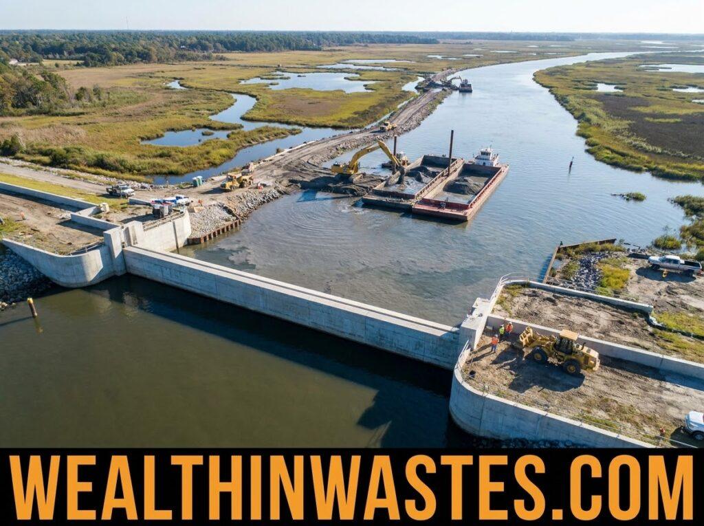
Sediment consists of soil particles, sand, silt, clay, gravel and other materials transported by flowing water or wind. It enters waterways through natural erosion, farming, construction, mining and poorly managed land surfaces.
1. Agricultural Runoff: Rain washes loose soil from exposed fields into drains, streams and rivers. This runoff can carry fertilisers, pesticides and other pollutants from different sources, reducing water quality and increasing treatment requirements.
2. Construction and Excavation: Roadworks, housing projects, quarrying and mining expose loose materials to rainfall. Without effective erosion controls, runoff transports these particles into waterways, where deposited sediment can obstruct channels and increase maintenance costs.
3. Reservoir Sedimentation: Sediment settles when flowing water enters slower-moving reservoirs and lakes. Accumulation reduces storage capacity, interferes with water intakes and may complicate water supply, irrigation and hydropower operations. Appropriate water abstraction and pollution controls support reliable supplies.
4. Damage to Aquatic Habitats: Excess sediment clouds water, reduces light penetration and can cover fish spawning grounds. Sediment deposition also alters habitats and harms freshwater ecosystems when excessive deposits overwhelm natural recovery processes.
5. Pollutant Transport: Fine particles can carry nutrients, pesticides, metals and other substances attached to their surfaces. When sediment settles or resuspends, it can move these pollutants between farmland, drainage channels, reservoirs and downstream water bodies.
Impacts on Water Resources and Communities
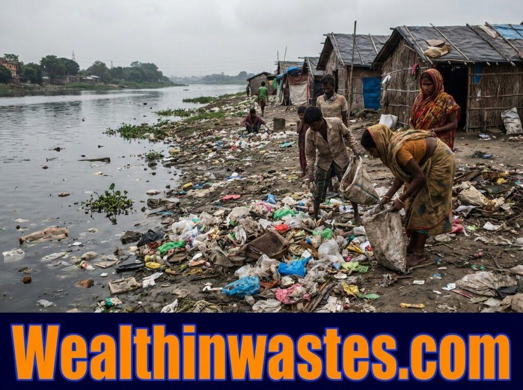
Erosion removes fertile topsoil, reduces crop productivity and increases farming costs. When fields lose organic matter and nutrients, farmers may struggle to maintain yields, particularly where rainfall is intense and opportunities for soil restoration are limited.
Flooding damages houses, roads, bridges, irrigation equipment, storage facilities and public utilities. It can interrupt transport, displace households, destroy harvested crops and livestock, and increase the cost of maintaining essential infrastructure.
Sediment accumulation makes reservoirs and irrigation canals less effective by reducing available storage and restricting water movement. Operators may need to remove deposits regularly to preserve reliable water delivery and protect important infrastructure.
Poor irrigation and drainage management can produce waterlogging and salinity problems. These conditions reduce root function, limit crop growth and weaken the long-term value of agricultural land, especially where excess water cannot drain away properly.
Sediment and floodwater may also carry sewage, animal waste, chemicals and other pollutants into drinking-water sources. Protecting community water supplies requires safe source locations, suitable sanitation and effective control of contamination pathways.
The combined effects extend beyond immediate physical damage because they threaten food security, public health, livelihoods and ecological stability. Communities therefore benefit from prevention measures that address erosion, flooding and sediment together.
Practical Methods to Control Erosion
Erosion control protects fertile topsoil, reduces sediment movement and helps rainfall enter the ground safely. Farmers and land managers should select appropriate practices according to soil type, slope, vegetation, rainfall intensity and available resources.
1. Reforestation and Vegetative Cover: Replanting trees, maintaining grass cover and protecting vegetation along rivers stabilise soil through their roots. These soil conservation practices also reduce raindrop impact, slow runoff and trap sediment before it reaches waterways.
2. Contour Farming and Strip Cropping: Farmers can cultivate across slopes rather than directly downhill. Alternating crops with grass strips slows surface runoff, creates barriers to moving soil and improves the opportunity for water to infiltrate.
3. Crop Rotation and Reduced Tillage: Rotating crops, planting cover crops and reducing unnecessary soil disturbance help maintain stable soil aggregates. Retained crop residues protect the surface, improve moisture retention and reduce the detachment of particles during rainfall.
4. Responsible Grazing and Forest Management: Farmers should match livestock numbers to the available vegetation and allow grazed land to recover. Replanting harvested trees and preventing uncontrolled burning also protect soil stability and sustain land-based livelihoods.
5. Mulching and Cover Crops: Spreading suitable plant residues across bare soil reduces raindrop impact and slows water movement. Cover crops provide living protection between main cropping seasons while improving soil structure and supporting biological activity.
6. Safe Land and Chemical Management: Preventing uncontrolled excavation, dumping and chemical spills protects soil and nearby watercourses. Properly managing land pollution risks also helps prevent contaminated runoff from spreading beyond the original site.
Flood Prevention and Sediment Management
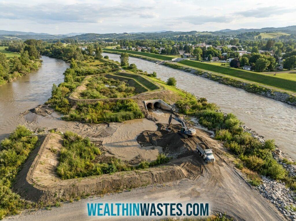
Flood prevention requires coordinated action across farms, towns, river corridors and entire catchments. Good management slows runoff, maintains drainage capacity, protects natural storage areas and reduces the quantity of sediment reaching rivers and reservoirs.
1. Integrated Watershed Management: Managing land, water and vegetation across an entire catchment helps reduce erosion and moderate flood peaks. Effective watershed pollution management also protects downstream communities and aquatic habitats.
2. Drainage Maintenance: Communities should inspect drains, culverts and waterways regularly, removing obstructions before heavy rainfall. Responsible handling of solid waste management problems reduces blockages that can cause flooding and carry refuse into streams.
3. Sediment Traps and Settling Ponds: Suitable basins, silt fences, check dams and sediment traps can slow runoff and capture suspended particles. Managers should inspect these structures regularly and remove accumulated sediment before it reduces their effectiveness.
4. Careful Site Selection: Construction, mining and waste disposal projects should consider drainage routes, soil stability and nearby water sources. A thorough environmental site assessment helps identify risks before development begins.
5. Wetland Protection and Flood Warnings: Wetlands and natural floodplains can store excess water and slow its movement downstream. Communities should protect these areas, monitor river levels and establish timely warnings that help residents prepare for dangerous conditions.
Sustainable Water Resources Development
Sustainable water resources development balances reliable water supplies, agricultural production, environmental protection and community needs. It requires long-term planning that considers how activities upstream influence flood risks, sediment loads and water quality downstream.
1. Integrated Resource Planning: Governments and communities should coordinate land use, drainage, irrigation, water supply and environmental protection. Assessing water quality conditions helps identify risks and guide practical measures for protecting essential supplies.
2. Community Participation: Farmers, residents, engineers, environmental officers and local authorities should work together to identify recurring problems. Community participation improves local knowledge, encourages maintenance and helps ensure that proposed solutions match practical needs.
3. Wastewater and Runoff Control: Towns and industries should collect and treat wastewater appropriately before discharge. Suitable wastewater treatment systems reduce contamination risks, while controlled drainage limits the movement of pollutants into rivers and groundwater.
4. Monitoring and Maintenance: Water managers should check river levels, sediment accumulation, water quality and drainage performance regularly. Monitoring helps identify emerging problems early, supports timely repairs and provides evidence for improving future water development decisions.
5. Long-Term Funding and Education: Governments should provide realistic budgets for maintaining drainage systems, restoring vegetation and managing sediment. Environmental education also helps farmers and residents understand how everyday land-use decisions affect water security and flood risks.
Read Also: Proper Methods of Disposal of Dilute Pesticide Waste
Summary on Erosion, Flooding and Sediment of Water Resources Development
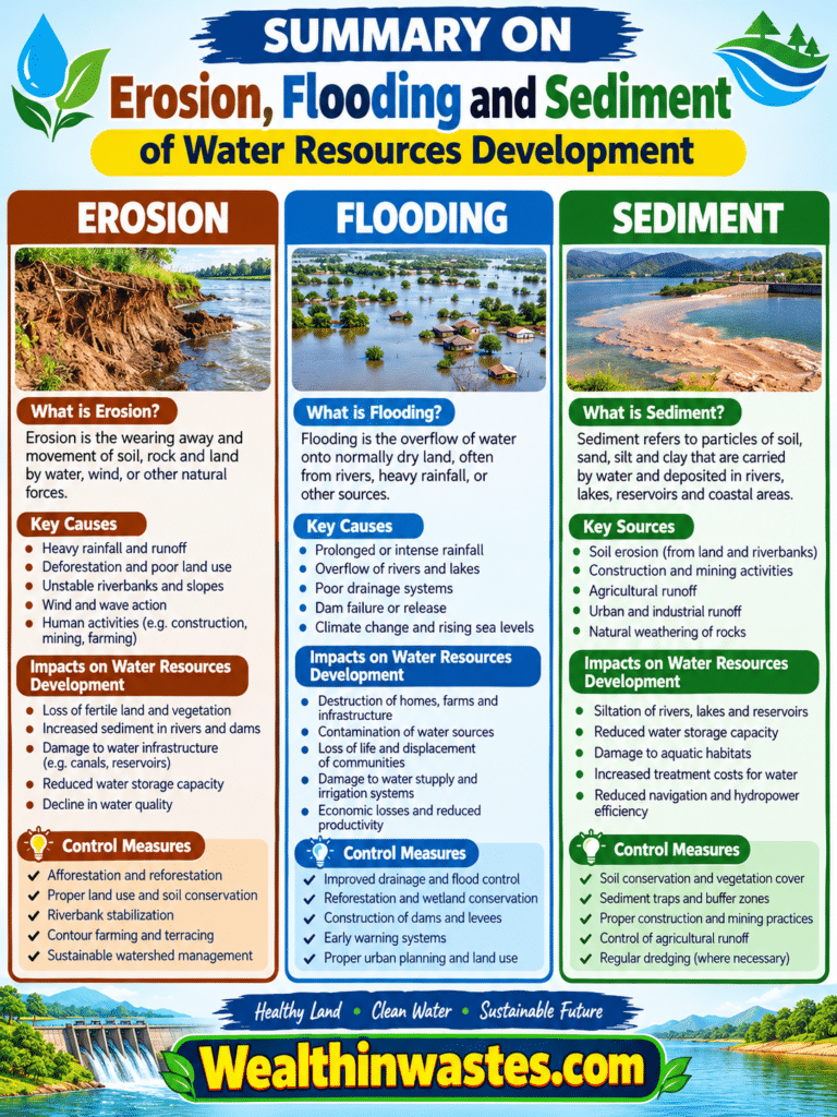
| Topic | Main Causes | Major Effects | Control Measures |
|---|---|---|---|
| Erosion | Heavy rainfall, wind, vegetation removal and poor cultivation | Topsoil loss, reduced fertility and increased sediment loads | Reforestation, contour farming, mulching and crop rotation |
| Flooding | Intense rainfall, blocked drains and floodplain development | Property damage, crop losses and disrupted water supplies | Drainage maintenance, flood warnings and wetland protection |
| Sedimentation | Soil erosion, construction and agricultural runoff | Reduced reservoir capacity, clogged canals and damaged habitats | Sediment traps, vegetation buffers and catchment management |
| Water Pollution | Contaminated runoff, waste disposal and wastewater discharge | Poor water quality and risks to people and wildlife | Wastewater treatment, pollution prevention and source protection |
| Sustainable Development | Poor planning and inadequate maintenance | Unreliable supplies and growing environmental and economic costs | Integrated planning, monitoring, community participation and funding |
Frequently Asked Questions About Water Resources Development: Erosion, Flooding and Sediment
1. What Is Erosion?
Erosion is the removal and transportation of soil or rock by water, wind, ice or other natural forces.
2. What Are the Main Agents of Erosion?
The main agents are running water, wind, groundwater, glaciers and marine forces, although their influence varies across different environments.
3. How Does Erosion Affect Water Resources?
Erosion increases sediment in rivers and reservoirs, reduces water storage capacity, damages aquatic habitats and raises water treatment costs.
4. What Causes Flooding?
Heavy rainfall, saturated soil, blocked drains, deforestation, urbanisation and development on floodplains can increase flood risks.
5. What Is Sedimentation?
Sedimentation occurs when transported particles settle and accumulate in rivers, lakes, reservoirs, irrigation canals or other receiving environments.
6. How Can Farmers Prevent Soil Erosion?
Farmers can use contour farming, crop rotation, mulching, cover crops, reduced tillage, suitable grazing practices and protective vegetation.
7. How Can Communities Reduce Flooding?
Communities can maintain drains, manage waste properly, protect wetlands, improve flood warnings and avoid building in high-risk floodplains.
8. Why Is Sediment Management Important?
Sediment management protects reservoir capacity, maintains irrigation channels, reduces water pollution and limits damage to aquatic habitats.
9. What Is Sustainable Water Resources Development?
It is the planned use and protection of water resources to meet present needs while maintaining environmental quality and future water availability.
10. How Does Vegetation Help Control Erosion and Flooding?
Vegetation protects soil from raindrop impact, stabilises slopes, slows runoff, encourages infiltration and traps sediment before it reaches waterways.
Do you have any questions, suggestions, or contributions? If so, please feel free to use the comment box below to share your thoughts. We also encourage you to kindly share this information with others who might benefit from it. Since we can’t reach everyone at once, we truly appreciate your help in spreading the word. Thank you very much for your support and for sharing!
Read Also: Soil and Water Conservation in Agriculture