


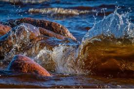
Water supports human life, food production, industry, energy generation, and healthy ecosystems. Understanding where water occurs, how it moves, and why its quantity and quality change is essential for effective planning.
Hydrology provides this understanding by applying scientific methods to water in the atmosphere, on land, beneath the ground, and within rivers, lakes, wetlands, and other environments across different spatial and temporal scales.
Its scope extends beyond identifying water sources; it examines the movement, storage, physical and chemical properties, and environmental interactions that determine how people and ecosystems access water over time and across landscapes.
Hydrologists investigate rainfall, evaporation, infiltration, runoff, groundwater recharge, flooding, drought, and water quality to explain changing conditions and help communities make evidence-based decisions for homes, farms, industries, and natural habitats.
Because water connects the atmosphere, soil, rocks, plants, animals, and human activities, hydrology draws on several scientific disciplines. This article explains its scope, methods, applications, and modern importance in managing limited water resources responsibly.
What Is Hydrology?
Hydrology is the scientific study of Earth’s water, including its occurrence, distribution, movement, physical and chemical properties, and relationships with the surrounding environment throughout the hydrologic cycle.
The discipline considers atmospheric moisture, precipitation, streams, lakes, wetlands, glaciers, soil moisture, and underground water. It also examines how water interacts with landforms, living organisms, and human settlements under varying environmental conditions.
Hydrology does not examine water as an isolated substance. Instead, it investigates the connections between water, energy, climate, geology, soils, vegetation, and human decisions across a river basin and larger regions.
For example, rainfall may infiltrate soil, replenish an aquifer, flow into a stream, or return to the atmosphere through evaporation and plant transpiration. Hydrology explains these connected pathways and their effects on local water supplies.
Read Also: Meaning and Scope of Environmental Geoscience
Scope of Hydrology and Its Main Components
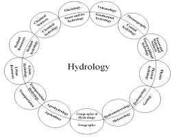
The scope of hydrology covers several connected aspects of water and its environment. Hydrologists investigate the following components to understand water availability, movement, quality, and interactions with natural systems.
1. Atmospheric Water and Precipitation: Hydrology examines water vapor, cloud moisture, rainfall, snow, and other precipitation forms. These inputs affect river flow, soil moisture, groundwater recharge, agricultural planning, and seasonal water availability in different regions.
2. Surface Water Bodies: The discipline studies streams, rivers, lakes, reservoirs, and wetlands, including their flow, storage, and seasonal changes. These observations help estimate available freshwater supplies and explain how water moves across landscapes over time.
3. Groundwater Resources: Hydrologists investigate underground reserves of freshwater, the geological materials that store them, and the rate at which rainfall replenishes them. This knowledge supports wells, boreholes, and sustainable extraction for households and farms.
4. Soil Moisture and Infiltration: Hydrology studies how water enters and moves through soil, how much moisture remains available to plants, and how surface conditions influence infiltration, drainage, and runoff after rainfall across different land uses.
5. Watersheds and Land Cover: Researchers assess how slopes, vegetation, urban surfaces, and changes in vegetation and surface cover affect the speed, direction, and quantity of water reaching channels and reservoirs during storm events and dry periods.
6. Water Quality and Environmental Interactions: Hydrologists examine water’s physical and chemical characteristics, suspended sediments, dissolved materials, and biological conditions. These factors influence drinking-water treatment, irrigation suitability, aquatic habitats, and industrial use in particular settings and communities.
The Hydrologic Cycle and Water Movement
Solar energy and gravity drive the hydrologic cycle, moving water through the atmosphere, land, rivers, and underground storage. Shifts in temperature and rainfall can change these processes and increase competition during droughts.
1. Evaporation and Transpiration: Sunlight turns water from oceans, rivers, lakes, and wet soils into vapor, while plants release moisture through transpiration. Together, these processes transfer water from land and vegetation into the atmosphere at different rates.
2. Condensation and Precipitation: As moist air cools, water vapor condenses into droplets or ice crystals, forming clouds. When droplets or crystals grow large enough, precipitation returns water to Earth’s surface as rain, snow, or other forms.
3. Infiltration and Percolation: Some precipitation enters the soil through infiltration, then moves downward through pores and fractures. This percolation replenishes groundwater where geological and soil conditions allow sufficient water to reach aquifers.
4. Runoff and Streamflow: Water that cannot infiltrate may flow over land as runoff, collect in channels, and move downstream. The volume and timing of this flow help determine reservoir inflow and flood peaks in a catchment.
5. Storage and Return Flow: Water remains temporarily in lakes, reservoirs, glaciers, soil, and aquifers before moving elsewhere. Storage smooths seasonal variations, but withdrawals and changing climate can alter its availability for people and ecosystems.
Water Resources and Water Quality Assessment

Hydrology helps communities determine how much water exists, where it occurs, when supplies are available, and whether quality meets intended needs. These questions guide safe, fair, and efficient resource decisions.
Water quality assessment examines temperature, turbidity, acidity, dissolved oxygen, nutrients, salts, microorganisms, and possible contaminants. Results help professionals judge suitability for drinking, irrigation, recreation, industry, and aquatic life under relevant standards.
Pollution can enter water through sewage, industrial discharge, agricultural runoff, erosion, or unmanaged waste. Hydrological information helps trace contamination pathways and prioritize controls before pollutants spread farther downstream into connected water bodies.
Water quality also affects health, food production, and ecosystems. Monitoring drinking-water sources and irrigation supplies can identify early risks to public health and ecosystems and help reduce exposure, crop damage, and ecological stress in affected communities.
Quantity and quality must be assessed together because abundant water may remain unsuitable for a particular purpose. Hydrologists therefore combine flow records, chemical tests, site observations, and local water-use needs.
Field Measurements and Hydrological Data
Fieldwork turns the processes of the hydrologic cycle into measurable evidence. Hydrologists collect observations repeatedly because rainfall, streamflow, soil moisture, and groundwater levels vary across locations and seasons, including during extreme events.
1. Rainfall and Weather Records: Rain gauges, weather stations, and radar estimates help quantify precipitation amount, intensity, and duration. Such records support comparisons between storms and improve estimates of the water entering a catchment.
2. Streamflow and River Levels: Staff gauges, flow meters, and current measurements help estimate discharge in rivers and streams. Long-term records reveal seasonal patterns and provide evidence for flood forecasting and water allocation in the basin.
3. Soil and Sediment Monitoring: Field teams examine soil moisture, infiltration, runoff, and soil loss caused by water. Sediment samples also show how erosion transfers material into channels, reservoirs, and downstream habitats after heavy rainfall.
4. Groundwater and Laboratory Tests: Observation wells and boreholes help record groundwater levels, while laboratory tests identify dissolved substances and other indicators. Researchers compare these results with field notes to interpret local conditions more reliably.
5. Sediment Analysis: Researchers examine sediment accumulating in channels to understand erosion, transport, and deposition. These measurements help explain changes in river depth, reservoir capacity, aquatic habitats, and the movement of pollutants through drainage systems.
Practical Applications of Hydrology
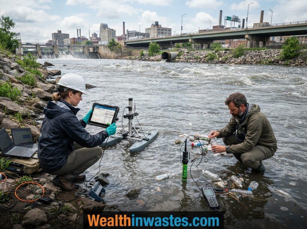
Hydrological knowledge helps professionals solve practical problems involving water availability, public safety, agriculture, and environmental protection. The main applications include the following areas.
1. Water Supply Planning: Hydrologists estimate dependable supplies from rivers, reservoirs, springs, and aquifers. Their assessments help communities size infrastructure, plan withdrawals, protect sources, and prepare for seasonal shortages in growing settlements and service areas.
2. Agriculture and Irrigation: Farmers and planners use rainfall, soil-moisture, and groundwater information to schedule irrigation, reduce wasted water, and match supplies to crop demand. These decisions protect production during dry periods where water is limited.
3. Flood and Erosion Risk: Flood studies estimate how much runoff a storm may generate and how quickly it may reach settlements. These estimates inform drainage design, warning systems, land-use planning, and emergency preparation in vulnerable areas.
4. Pollution and Waste Control: Hydrologists trace runoff, leachate, and wastewater movement to identify how poorly managed solid waste can threaten streams and groundwater. Their findings guide source protection and safer disposal decisions.
5. Ecosystem Conservation and Recovery: Hydrological assessments help maintain wetlands, river habitats, and environmental flows that support fish, plants, and wildlife. After damage, monitoring guides environmental harm and restoration by measuring water recovery over time.
Farmers can also apply hydrological findings alongside soil-conservation practices to improve infiltration, limit runoff, and retain moisture. These combined measures can strengthen agricultural resilience and reduce pressure on freshwater resources.
The Interdisciplinary Nature of Hydrology
Hydrology overlaps with geography, geology, physics, chemistry, biology, meteorology, oceanography, and engineering. Each discipline explains a different part of water behavior, from rainfall formation to underground flow and ecosystem response across connected environments.
Geologists explain how rock layers and soil structure control infiltration and aquifer storage, while chemists analyze dissolved substances. Knowledge of soil and geological materials therefore strengthens water-resource investigations and source protection.
Biologists study how organisms depend on water quantity and quality, while engineers design drains, dams, and treatment facilities. Their work must also consider land pollution and contamination moving toward rivers or aquifers near communities.
Geographers and climate scientists map catchments, examine weather patterns, and compare conditions across time. These perspectives help hydrologists interpret why two river basins may respond differently to similar rainfall or development pressures.
Read Also: Protection and Development of Water Resources Guide
Modern Tools and Challenges in Hydrology
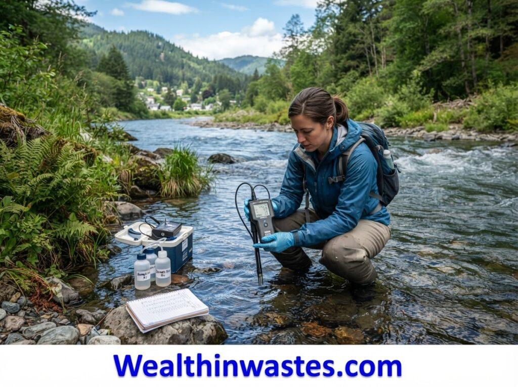
Modern hydrologists use computers to organize large datasets, calculate water balances, test scenarios, and build models of floods or groundwater flow. Models support decisions, but they need reliable observations and appropriate assumptions.
Geographic information systems, satellite imagery, remote sensing, and digital elevation models help map watersheds and identify changing land surfaces. These tools let teams assess broad areas that field stations cannot cover alone.
Computer models cannot remove uncertainty from hydrological studies. Sparse monitoring, changing land use, extreme weather, and incomplete records can affect predictions, so professionals should report assumptions and update analyses when new evidence appears.
Researchers also examine floodwater and sediment movement to improve catchment planning. Effective community monitoring and response to pollution help decision-makers share risks, coordinate action, and protect vulnerable sources more effectively.
Reliable hydrological management requires continued investment in monitoring equipment, trained personnel, laboratory facilities, and data-sharing systems. These resources help communities respond to changing water conditions and make better long-term decisions.
Summary on Scope of Hydrology: Key Areas, Methods and Applications
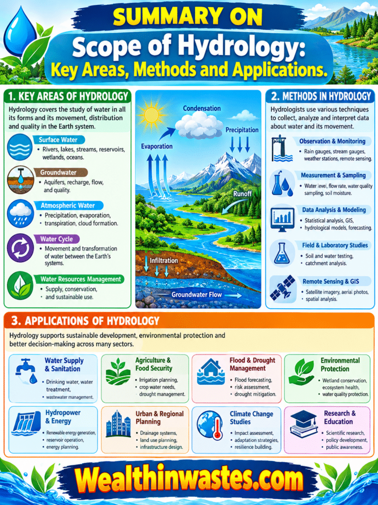
| Aspect | Summary |
|---|---|
| Definition | Hydrology is the scientific study of water, including its occurrence, distribution, movement, properties, and environmental interactions. |
| Main Scope | It covers precipitation, surface water, groundwater, soil moisture, watersheds, water quality, and the hydrologic cycle. |
| Key Processes | Evaporation, transpiration, condensation, precipitation, infiltration, runoff, groundwater recharge, and streamflow describe water movement. |
| Research Methods | Field measurements, laboratory analysis, statistical techniques, remote sensing, and computer modeling support hydrological investigations. |
| Practical Applications | Hydrology supports water supply, irrigation, flood management, erosion control, pollution prevention, and ecosystem conservation. |
| Related Disciplines | Geography, geology, chemistry, physics, biology, meteorology, oceanography, and engineering contribute to hydrological research. |
| Modern Importance | Hydrology provides evidence for sustainable water management, climate adaptation, environmental protection, and informed planning. |
Frequently Asked Questions About Scope of Hydrology: Key Areas, Methods and Applications
1. What Is Hydrology?
Hydrology is the scientific study of water, including its occurrence, distribution, movement, properties, and interactions with the environment throughout the hydrologic cycle in the atmosphere, on land, and underground across different regions.
2. What Does the Scope of Hydrology Include?
It includes precipitation, evaporation, runoff, infiltration, groundwater, river flow, water quality, field measurements, data analysis, forecasting, and water-resource planning for communities and ecosystems across urban, rural, and natural environments alike.
3. Why Is the Hydrologic Cycle Important?
It explains how water moves between the atmosphere, surface, soil, and underground storage, helping scientists understand water availability, drought, flooding, and ecosystem requirements in different seasons and locations over time.
4. How Do Hydrologists Collect Data?
They use rain gauges, river gauges, flow meters, observation wells, remote sensing, field surveys, and laboratory tests, then analyze the results using statistical and computer-based methods to identify patterns and estimate future conditions.
5. How Does Hydrology Help Agriculture?
It helps farmers plan irrigation, estimate available water, track soil moisture, manage drainage, reduce erosion, and prepare for droughts or excessive rainfall while improving water-use efficiency across changing seasonal conditions.
6. Does Hydrology Study Groundwater?
Yes. Hydrology examines groundwater recharge, movement, storage, extraction, and quality. These studies help communities locate water supplies, monitor aquifers, and reduce depletion or contamination risks through appropriate management and monitoring.
Do you have any questions, suggestions, or contributions? If so, please feel free to use the comment box below to share your thoughts. We also encourage you to kindly share this information with others who might benefit from it. Since we can’t reach everyone at once, we truly appreciate your help in spreading the word. Thank you very much for your support and for sharing!
Read Also: Common Irrigation Resources in Nigeria