


Hydrology is the scientific study of water, including its occurrence, movement, distribution, storage, and quality across the Earth. It explains how water connects the atmosphere, land, ecosystems, and human activities.
People depend on water every day for drinking, sanitation, food production, transport, manufacturing, energy, recreation, and environmental health. Managing this essential resource requires reliable information about its quantity, quality, and availability.
Hydrologists gather and interpret rainfall, river flow, groundwater, soil moisture, and evaporation data. They use field observations, maps, measurements, and computer models to understand water movement and support practical decisions.
This knowledge helps communities plan water supplies, farmers schedule irrigation, engineers design drainage systems, and authorities prepare for floods or droughts. It also supports efforts to protect rivers, lakes, wetlands, and aquifers.
The applications of hydrology therefore reach far beyond scientific research. Understanding how to apply hydrology in society shows why careful water planning strengthens public health, economic activity, infrastructure, agriculture, and environmental sustainability.
Applying Hydrology in Society
Hydrology serves any human activity that depends on water. Its principles help people understand where water comes from, how it moves through landscapes, how much remains available, and how human actions affect it.
Hydrologists combine scientific observations with mathematical analysis to address problems involving water quantity, quality, timing, and distribution. Their findings help decision-makers compare options instead of relying on assumptions or guesswork.
For example, local authorities can use hydrological records to estimate future demand and identify shortages before they become emergencies. Such evidence improves water resource planning and investment priorities for growing communities and local services.
Hydrology also explains how pollution travels from farms, settlements, roads, and industries into streams or groundwater. Understanding these pathways helps communities anticipate environmental damage and reduce the economic costs associated with pollution.
The discipline supports both large public projects and small household decisions. National agencies may plan a reservoir, while residents use local drainage knowledge to prevent waterlogging around homes and protect nearby wells.
Because water systems cross political and property boundaries, effective hydrological management requires cooperation. Planners, engineers, farmers, environmental specialists, communities, and governments achieve stronger results when they share information and coordinate their actions.
Read Also: Proper Methods of Disposal of Dilute Pesticide Waste
Hydrology for Water Supply and Reservoirs

1. Estimate Available Water: Hydrologists examine rainfall records, river levels, streamflow, groundwater recharge, and seasonal changes to estimate supplies. Their assessments help cities and communities decide whether local sources can meet present and future demand.
2. Select Suitable Sources: Field surveys and hydrological measurements help planners compare rivers, lakes, reservoirs, springs, and aquifers. These checks can reveal seasonal limits, competing uses, and contamination risks before major public investments begin.
3. Plan Reservoir Capacity: Topographic maps, rainfall estimates, catchment characteristics, and flow records help engineers estimate storage capacity and likely water levels. They also identify shorelines that might threaten roads, railways, farms, or homes.
4. Coordinate Water Releases: Reservoir managers balance stored water against expected inflows, drinking needs, irrigation demand, electricity generation, recreation, and downstream requirements. Hydrological forecasts help them choose release schedules that reduce shortages and unnecessary losses.
5. Protect Drinking Water: Measurements upstream of treatment plants help utilities recognise changing sediment loads and possible contamination. Understanding how water pollution is classified supports better source protection and treatment planning.
6. Improve Supply Reliability: Hydrological data help authorities prepare for seasonal low flows and periods of unusual demand. Knowledge of pollutant types and sources helps managers protect supplies, while water pollution prevention reduces risks to local sources.
Hydrology in Agriculture and Irrigation
1. Calculate Crop Water Needs: Hydrologists study rainfall, evaporation, soil moisture, and crop demand to estimate when fields need additional water. These assessments help farmers schedule irrigation and avoid both crop stress and wasteful overwatering.
2. Choose Reliable Water Sources: Understanding streamflow, shallow groundwater, and seasonal recharge helps farmers select workable supplies. Sound assessment also reduces the risk of pumping aquifers faster than rainfall and natural seepage can replenish them.
3. Improve Irrigation Efficiency: Water measurements help farmers match application rates to field conditions and crop stages. Better scheduling limits runoff, waterlogging, and deep percolation, while maintaining sufficient moisture for healthy plant growth and development.
4. Reduce Soil Loss: Hydrological knowledge reveals how rainfall intensity, slope, soil type, and land cover influence runoff. Practices described in soil conservation planning can protect topsoil and retain water on farms.
5. Assess Farmland Suitability: Water availability and drainage influence which crops a location can support. Farmers and planners can combine hydrological evidence with land suitability information before investing in cultivation or irrigation infrastructure.
6. Maintain Productive Resources: Irrigation planning must account for salinity, drainage, soil structure, and long-term water availability. Integrating hydrology with responsible soil resource management helps farms remain productive without degrading nearby land and water.
Hydrology for Flood and Drought Control
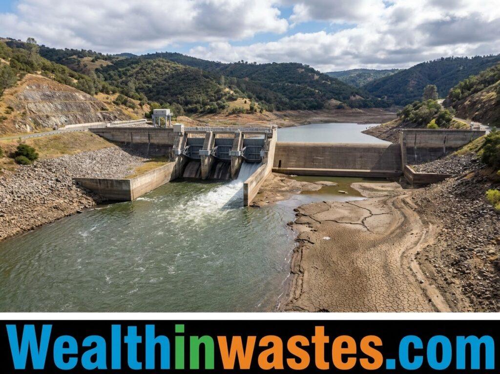
1. Forecast Flood Conditions: Rainfall records, river gauges, soil saturation, and catchment characteristics help specialists estimate how quickly water levels may rise. Forecasts give emergency teams time to warn residents and protect vulnerable facilities.
2. Map Flood-Prone Areas: Hydrological modelling identifies locations where water may spread during severe storms. Communities can use these maps to guide building decisions, preserve floodplains, and avoid placing essential services in risky areas.
3. Design Drainage Systems: Engineers use rainfall intensity and runoff estimates to size drains, culverts, and channels. Suitable capacity helps urban areas move stormwater safely instead of allowing roads, markets, homes, and farms to flood.
4. Understand Erosion and Sediment: Flow speed and runoff volume influence how water removes and transports soil. Knowledge of erosion, flooding, and sediment movement helps protect channels, reservoirs, farmland, bridges, and downstream communities.
5. Reduce Soil Instability: Water can weaken slopes when rainfall saturates soil or changes groundwater pressure. Information about soil erosion processes helps planners reduce surface loss and recognise locations vulnerable to landslides.
6. Prepare for Drought: Monitoring rainfall deficits, reservoir storage, river discharge, and groundwater levels can reveal developing water shortages. Changes in vegetation and land cover, including deforestation-related impacts, also affect runoff and water retention.
Water Quality, Pollution, and Public Health
1. Monitor Drinking Water: Hydrologists collect samples and track changes in rivers, lakes, wells, and reservoirs. Their findings help utilities and public health officials identify risks and decide when further testing or treatment is necessary.
2. Trace Pollution Pathways: Runoff, infiltration, and groundwater flow can carry contaminants far from their original sources. Learning about the sources and forms of water pollution helps specialists target prevention efforts.
3. Investigate Contamination: Sampling programmes can test for pathogens, nutrients, metals, pesticides, and industrial chemicals. Results help teams locate possible sources, understand how contaminants move, and prioritise action to protect people and aquatic habitats.
4. Improve Wastewater Control: Hydrological evidence shows where sewage or industrial discharges may enter waterways and how flows may spread them. Appropriate water pollution control practices reduce exposure and environmental damage.
5. Protect Aquatic Life: Water temperature, dissolved oxygen, acidity, and nutrient levels affect fish, plants, and other organisms. Monitoring these conditions helps environmental teams identify harmful changes before they cause wider ecosystem disruption or losses.
6. Plan Pollution Reduction: Data from rivers and groundwater can reveal whether management efforts are working over time. Communities can combine monitoring with practical pollution-reduction strategies to lower risks and restore water quality.
Hydrology in Infrastructure and Energy
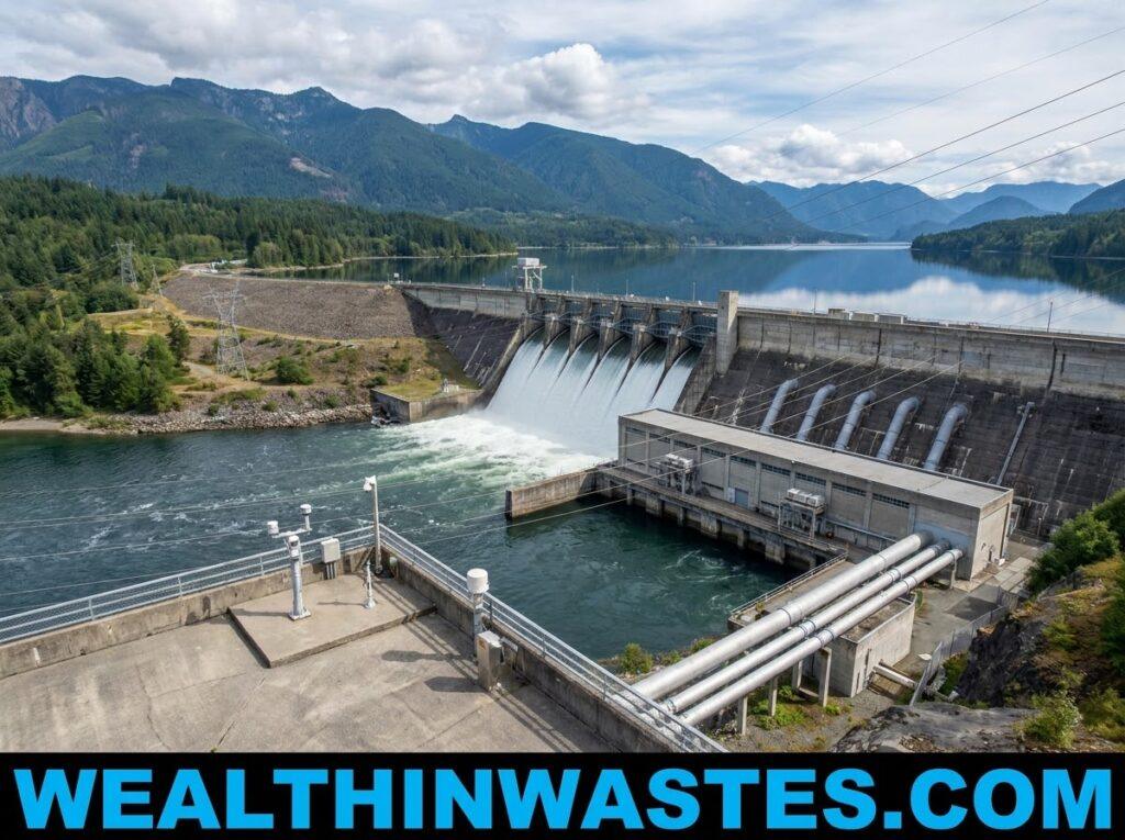
1. Design Bridges and Culverts: Engineers use peak-flow estimates to determine the water openings that bridges and culverts need. Appropriate designs reduce blockage, structural damage, traffic disruption, and risks to people during heavy rainfall.
2. Plan Urban Drainage: Hydrological analysis estimates how roofs, roads, paved compounds, and other surfaces change runoff. These estimates guide drain capacity, retention ponds, and other measures that manage stormwater in growing towns and cities.
3. Support Hydropower: Hydrologists analyse river flow, seasonal variability, and reservoir behaviour to estimate dependable water for electricity generation. Their work supports operating plans that balance energy production with drinking water, irrigation, and downstream needs.
4. Protect Construction Sites: Water movement can undermine foundations, wash away exposed soil, and carry sediment into streams. Assessing environmental risks from poorly managed waste also helps project teams plan safer handling and drainage.
5. Manage Contaminated Land: Engineers need to understand how infiltrating water may carry chemicals from waste sites toward wells or streams. Appropriate land pollution assessments help guide monitoring, remediation, and safer facility locations.
6. Maintain Public Infrastructure: Regular inspection of drains, channels, dams, and embankments helps identify damage before it becomes severe. Hydrological records allow managers to prioritise maintenance and test how infrastructure performs under different flow conditions.
Hydrology for Environmental Protection
1. Protect Wetlands and Rivers: Hydrology explains how water levels, flow timing, and groundwater connections sustain wetland plants and habitats. Managers use this knowledge to maintain environmental flows and reduce harmful changes to sensitive ecosystems.
2. Support Sustainable Resource Use: Water planning should meet community needs without exhausting supplies or damaging ecosystems. Linking hydrology with resource conservation principles encourages careful use and protects options for future generations.
3. Evaluate Land-Use Change: Roads, buildings, mining, and vegetation removal can change infiltration and runoff. Hydrological assessments reveal how these changes affect streamflow, water storage, sediment delivery, and the resilience of neighbouring communities.
4. Monitor Water Systems: Agencies compare water measurements over time to detect unusual changes and assess management results. Clear responsibilities and effective institutional coordination help turn monitoring information into practical environmental action.
5. Protect Groundwater: Hydrologists identify recharge areas, estimate groundwater movement, and help place monitoring wells near possible contamination sources. Regular sampling can reveal whether polluted seepage is approaching aquifers used for drinking or irrigation.
6. Assess Environmental Change: Comparing rainfall, streamflow, groundwater, and water quality records helps researchers understand changing conditions. This evidence supports adaptation plans that safeguard water availability while recognising uncertainty and the needs of local ecosystems.
Everyday Decisions That Benefit From Hydrology

Hydrology is useful beyond major infrastructure projects because households, schools, farms, and neighbourhood groups also make water-related decisions. Understanding local water movement can prevent damage and encourage sensible use of available supplies.
Homeowners can observe where rainwater collects, how quickly soil absorbs it, and whether gutters discharge safely. These observations help identify simple drainage improvements before standing water damages buildings or creates nuisance conditions.
Community leaders can use rainfall and flood information to organise warnings, protect evacuation routes, and discourage construction in dangerous low-lying areas. Public awareness becomes stronger when technical findings are explained clearly and locally.
Schools and environmental groups can monitor nearby streams, record rainfall, and report visible changes. Consistent observations contribute to environmental monitoring programmes and help local residents recognise emerging water problems early.
Local businesses also benefit when they understand water availability, drainage requirements, and pollution risks. Knowledge of different forms of environmental pollution can inform safer operations and more responsible waste handling practices.
Ultimately, hydrology helps society make informed choices by connecting water measurements with practical needs. Its greatest value emerges when reliable evidence, community experience, sound engineering, and long-term environmental responsibility guide decisions together.
Read Also: Freshwater and the Need for Sustainable Management
Summary on How to Apply Hydrology in Society: Key Uses and Benefits
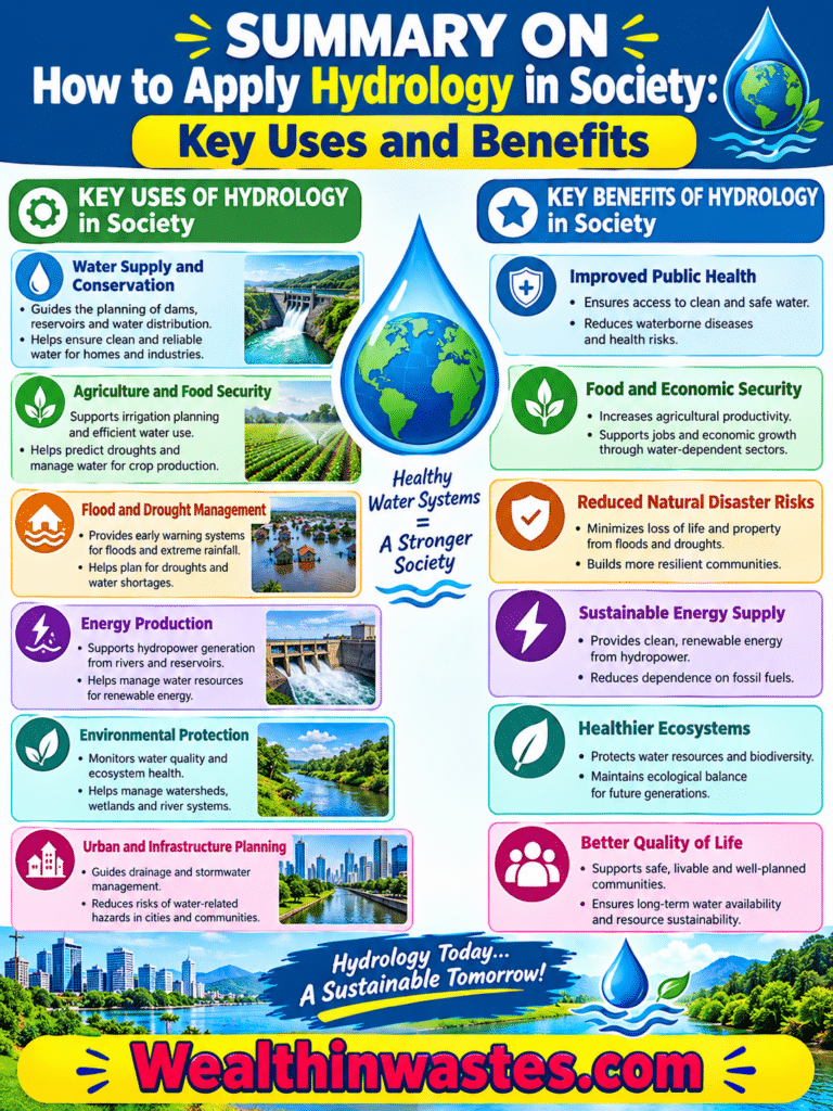
| Application | How Hydrology Helps | Societal Benefit |
|---|---|---|
| Water Supply | Estimates source reliability, demand, and reservoir storage. | Improves access to dependable water. |
| Agriculture | Guides irrigation timing, drainage, and soil moisture management. | Supports crop production and reduces waste. |
| Flood and Drought Control | Uses rainfall, flow, and storage data to anticipate extremes. | Reduces losses and supports preparedness. |
| Water Quality | Tracks pollutants and identifies contamination pathways. | Protects public health and aquatic ecosystems. |
| Infrastructure and Energy | Informs designs for bridges, drains, dams, and hydropower. | Improves safety, reliability, and service life. |
| Environmental Protection | Evaluates groundwater, wetlands, land-use change, and river flows. | Promotes sustainable water resource management. |
Frequently Asked Questions About How to Apply Hydrology in Society: Key Uses and Benefits
1. What Is Hydrology Used For?
Hydrology helps society assess water supplies, manage rivers and reservoirs, plan irrigation, reduce flood risks, monitor pollution, design infrastructure, protect groundwater, and support long-term environmental sustainability for communities in the future.
2. How Does Hydrology Help Farmers?
Farmers use hydrological information to estimate crop water needs, schedule irrigation, assess water sources, improve drainage, reduce erosion, and protect soil moisture while keeping limited freshwater resources dependable for local farms.
3. How Does Hydrology Reduce Flood Damage?
Rainfall and river-flow measurements support flood forecasts, hazard maps, warning systems, and drainage designs. These tools help communities prepare, reduce damage to homes and farms, and organise safer emergency responses.
4. What Role Does Hydrology Play in Water Quality?
Hydrologists track water conditions, sample rivers and groundwater, and study how contaminants move. Their findings help authorities identify pollution sources, select treatment measures, protect public health, and guide follow-up action.
5. Can Hydrology Help Prevent Drought Shortages?
Hydrology cannot prevent drought, but monitoring rainfall, groundwater, river discharge, and reservoir storage can reveal shortages early and help authorities plan conservation, allocation, emergency supplies, and timely restrictions through public guidance.
6. Why Is Hydrology Important for Sustainable Development?
Hydrology helps balance human water needs with ecosystem protection by guiding careful withdrawals, pollution control, infrastructure planning, and long-term management of rivers, aquifers, wetlands, and reservoirs for people, farming, industry, and wildlife.
Do you have any questions, suggestions, or contributions? If so, please feel free to use the comment box below to share your thoughts. Your feedback can help improve this article for other readers.
We also encourage you to kindly share this information with others who might benefit from it. Since we can’t reach everyone at once, we truly appreciate your help in spreading the word.
Thank you very much for your support and for sharing! Your contribution helps more readers discover this information and apply it thoughtfully in their communities. This shared effort supports water awareness and responsible resource management.
Read Also: Hydrologic Cycle and Its Importance in Agricultural Water Management